Krafthweg Rothenthurm - with Krafth over the Morgartenberg


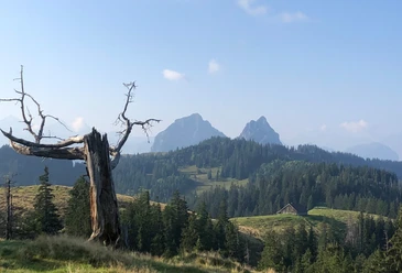
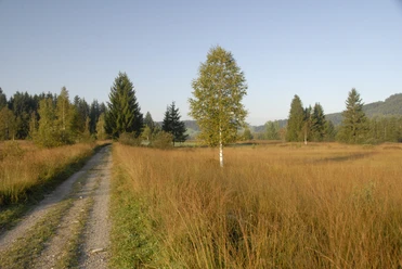
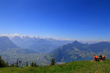
The approximately 3-hour Krafthweg starts at the train station and soon leads uphill towards Chli Morgarten. In Gärtenboden there is already a beautiful fire pit with a covered seating area. Once you have made the ascent to Morgartenberg, enjoy the unique view and a leisurely descent.
Stations invite you to strengthen yourself
Along the adventure route you will find various stations that invite you to try out, compete and strengthen yourself. Challenge yourself on a fitness stairway with bell toll, hop over the bear steps, or balance on the slackline.
Krafth package for on the go
The right provisions make the Krafthweg an unforgettable experience. Enjoy our specially compiled Krafth package from Kronenmetzg as a picnic on the way.
#rothenthurmhatkrafth
- 3:00 h
- 9.64 km
- 358 m
- 358 m
- 910 m
- 1,243 m
- 333 m
- Start: Rothenthurm Train Station
- Destination: Rothenthurm Train Station
Good to know
Pavements
Best to visit
Directions
Rothenthurm 920 m.a.s.l. - Mösli Brugg 910 m.a.s.l. - Chli Morgarten 1069 m.a.s.l. - Morgartenberg 1243 m.a.s.l. - Bibergegg 933 m.a.s.l. - Rothenthurm
Tour information
Loop Road
Equipment
Shoes with good soles or trekking shoes, rain jacket, drink, provisions, possibly poles.
Directions & Parking facilities
Paid parking spaces near the church.
Rothenthurm is very well accessible by public transport.
The SBB/Southeast Railway (SOB) run every half hour from Zurich to Rothenthurm.
Hourly, you can travel from Eastern Switzerland as well as from the greater Lucerne area with the "Voralpen-Express" (line Romanshorn – Lucerne) to Rothenthurm.
Additional information
Author
Erlebnisregion Mythen
Organization
Erlebnisregion Mythen
Author´s Tip / Recommendation of the author
Nearby
Download GPX file