Rothenthurm Thorthour


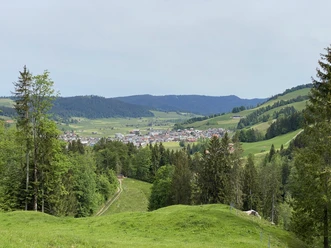
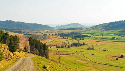
The circular hike, which is walkable from both sides, starts at Rothenthurm station and leads approximately in the middle to the Rothenthurm local mountain Nüsellstock. The two ends are marked by Katzenstrick on the footpath to Einsiedeln and on the other side by Hochstuckli in the municipality of Sattel. The mostly lonely hiking trail winds its way over this route through forests and untouched nature, at times also through the Rothenthurm raised bog.
Can be walked in stages
The entire Thorthour stretches over 28 kilometers and around 1400 meters of elevation gain. It takes eight to nine hours without breaks – making it a real challenge for both hiking enthusiasts and experienced trail runners. However, ascent or descent to Rothenthurm, Sattel, Alpthal, Trachslau, or Einsiedeln is possible almost at any time. Those who prefer a more leisurely pace can also easily divide the hike into stages.
Enough drinks and picnic
The right provisions make the Thorthour an unforgettable experience. Enjoy our specially prepared power package from Kronenmetzg as a picnic along the way.
#rothenthurmhatkrafth
- 9:00 h
- 26.92 km
- 1,012 m
- 1,035 m
- 904 m
- 1,565 m
- 661 m
- Start: Rothenthurm station
- Destination: Rothenthurm station
Good to know
Pavements
Best to visit
Directions
Tour information
Loop Road
Equipment
Directions & Parking facilities
From Pfäffikon SZ or Schwyz via the H8 to Rothenthurm.
Paid parking spaces near the church.
Accessible by train and bus
Rothenthurm is very well accessible by public transport.
The SBB/South Eastern Railway (SOB) run every half hour from Zurich to Rothenthurm.
Hourly services run from Eastern Switzerland and the Lucerne metropolitan area with the "Voralpen-Express" (Romanshorn - Lucerne line) to Rothenthurm.
Additional information
Author
Erlebnisregion Mythen
Organization
Schwyzer Wanderwege
Author´s Tip / Recommendation of the author
Safety guidelines
Between Altmatt - Rothenthurm, be cautious due to shooting exercises of the Swiss Army. Further information and dates can be found here.
Nearby

Download GPX file