Moorweg Rothenthurm


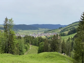
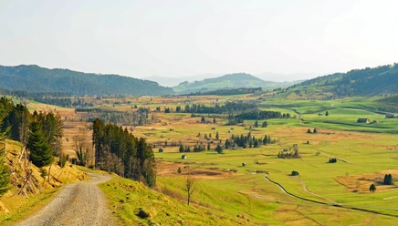
The Moorweg offers a lot of variety: You walk on gravel roads, on animal tracks, and over wooden plank paths through a mosaic of different habitats. The route leads through wide, open areas and through forests where attentive hikers can hear various animal sounds.
You start at Biberbrugg station and branch off from the road route through the Witi raised bog. You cross the Biber River and walk over the reed meadows. At the Bibersteg, you follow the path for a stretch along the Biber. The path is generally well signposted as SwitzerlandMobility Route 835. On the way towards Rothenthurm, barbecue spots and benches invite you to rest. The moorlands in Rothenthurm became nationally known in the 1980s when a popular initiative to protect the moors prevented the construction of a military training area. Thus, Rothenthurm was the first Swiss moorland to be placed under nature protection. At the destination, you can still see the Letziturm and the parish church of St. Antonius.
- 2:45 h
- 11.05 km
- 78 m
- 171 m
- 830 m
- 930 m
- 100 m
- Start: Biberbrugg station
- Destination: Rothenthurm station
Good to know
Pavements
Best to visit
Directions
Biberbrugg 830 m above sea level - Bibersteg 908 m above sea level - Almigforen 907 m above sea level - Möslibrugg 910 m above sea level - Rothenthurm 920 m above sea level
Tour information
Nature Highlight
Directions & Parking facilities
Biberbrugg is located on the H8 between Pfäffikon and Schwyz.
Parking spaces at the station.
By train to Biberbrugg station.
Author
Schwyzer Wanderwege
Organization
Schwyzer Wanderwege
Author´s Tip / Recommendation of the author

Nearby
