Maighel Pass bike route


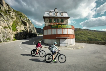
From Andermatt, the route leads along the pass road to the Oberalp. Those who take the standard route leave the paved road at the pass height and descend via Pass Tiarms through Val Val to Tschamut. From there, you reach Surpalits and Milez on the pass road, where you come onto an unpaved road. This leads moderately uphill into Val Maighels, where the Maighel Hut sits on the left side of the slope. Tip: Those who want to can shorten the way by riding directly from Oberalp Pass to Surpalits instead of going via Pass Tiarms and Tschamut.
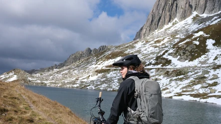
Through Val Maighels, the unpaved road gradually turns into a hiking trail; with late snowmelt, you may also encounter individual snowfields. From Maighel Pass, the view opens up to mountains like Gemsstock, Pizzo Centrale, and Giübin. Those who don’t mind cold water can take a bath in the mountain lake. From Maighel Pass follows a steep, demanding descent into the Unteralp valley back to Andermatt.
- 4:30 h
- 32.99 km
- 1,271 m
- 1,271 m
- 1,436 m
- 2,422 m
- 986 m
- Start: Andermatt Train Station
- Destination: Andermatt Train Station
Good to know
Pavements
Best to visit
Directions
Tour information
Loop Road
Nature Highlight
Stop at an Inn
Equipment
- Daypack
Directions & Parking facilities
Andermatt is very well accessible in summer from all four directions and is therefore a pleasant starting point.
In Andermatt, directly behind the train station, there is a large parking lot.
Andermatt is the connecting point of the Matterhorn Gotthard Railway and is therefore very well accessible by train. The timetable is as follows: SBB timetable
Additional information
Author
Andermatt-Urserntal Tourismus GmbH
Organization
Région de vacances Andermatt
Author´s Tip / Recommendation of the author
- Stone cairn colony in Val Maighels
- Portgerensee, beautiful picnic spot
Safety guidelines
Note the road closures and weather forecasts.
Nearby

Download GPX file