Round tour Göscheneralp


You start at the tourist office in Andermatt. First, follow the hiking trail through the Schöllenen Gorge. Caution: hikers are often on this path! The rock walls rise impressively, and you can still easily imagine the obstacle this gorge posed to travelers of earlier times. At the end of the Schöllenen, cross the Häderlis Bridge, then continue on the main road to Göschenen.
In Göschenen village center, cross the bridge and then turn left towards Göscheneralp. At the village exit, the first ramp leads up just before Abfrutt; before the small hamlet, turn left onto a natural road. In Wiggen, the valley narrows; across the Göschenerreuss, return to the paved road, which passes through some unlit tunnels – a lighting set is absolutely necessary! After some hairpin bends, you reach the small road through a tunnel and then through a rock wall before arriving at the valley basin by the campground in Gwüest. Here, the view opens onto the grassy dam.
At the Göscheneralp restaurant in Gwüest, you will find the first opportunity to stop for refreshments. Those looking for simple overnight accommodation will find it here too. From the restaurant, continue on the small road to the dam. The Dammagletscher restaurant here offers relief for empty stomachs and dry throats.
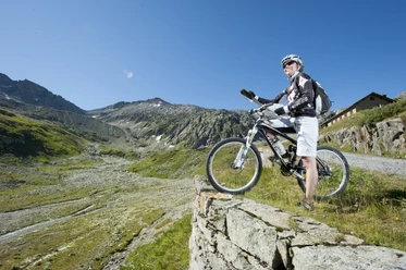
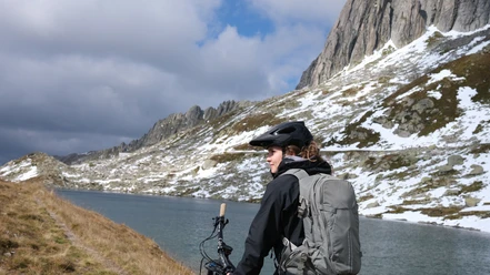
The path to the start of the descent runs directly over the dam. A short stop is worthwhile: the view of the Göscheneralpsee, the glaciers, and mountains is fantastic. Tiefen-, Rhone-, Damma-, Schnee-, and Eggstock are still snow-covered in summer. The descent then leads you directly over the dam to the “old valley floor”; the initial road merges into a narrow hiking trail. Just before the path turns back into a small road, some large boulders force even experienced bikers to dismount for a few meters. The next challenge awaits you after the campground, where the path goes over some very rocky passages – a delight for experts. Less technically skilled riders will push their bikes for a maximum of 15 minutes. From Wiggen onward, the route follows the same path as uphill until just before Göschenen – all on the hiking trail.
- 3:14 h
- 24.89 km
- 701 m
- 1,038 m
- 1,097 m
- 1,798 m
- 701 m
- Start: Andermatt
- Destination: Göschenen
Good to know
Pavements
Best to visit
Directions
Tour information
Stop at an Inn
Author
Ferienregion Andermatt
Organization
Lucerne Tourisme
Author´s Tip / Recommendation of the author
Option A: Start and finish in Göschenen.
Option B: Departure from the dam back to Wiggen on the road, to bypass the technical trail sections.
Safety guidelines
Hikers frequently use the trail through the Schöllenen Gorge.
The route passes through some unlit tunnels – a lighting set is absolutely necessary.
Nearby