Wildspitz Höhronen


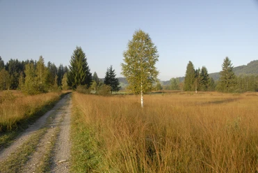
The hike starts at Biberbrugg station. From there it goes uphill towards Fuseli and then to Wildspitz. Further on towards Höhronen and Chlausenchapperli or Raten. Up to this point, the hike is almost entirely in the forest and quite doable especially in spring. Note the lekking and breeding season of the capercaillie. This lasts from April to July and affects the area from Dreiländerstein to Langenegg. Information is posted on site during this time.
At Raten, the hike continues along the Ratengütsch to St. Jost. Then the path slowly descends towards Tänndli until Rothenthurm is reached. From here, there are train and bus connections again. There are several places to stop for refreshments, linked in the route.
- 4:20 h
- 13.72 km
- 542 m
- 432 m
- 828 m
- 1,225 m
- 397 m
- Start: Biberbrugg station
- Destination: Rothenthurm
Good to know
Pavements
Best to visit
Directions
Biberbrugg - Wildspitz - Höhronen - Raten - St. Jost - Tänndli - Rothenthurm
Tour information
Stop at an Inn
Equipment
Hiking shoes with good tread or trekking shoes, rain jacket, drink, provisions, possibly poles.
Directions & Parking facilities
To Biberbrugg station.
Parking available at Biberbrugg station
Bus or train to Biberbrugg.
Return journey from Rothenthurm station.
Author
Stefan Gwerder
Organization
Schwyzer Wanderwege
Author´s Tip / Recommendation of the author
Delicious lunch on the Raten or a coffee at St. Jost
Nearby