Muotathal - Pfannenstock


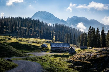
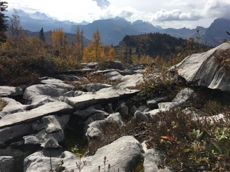
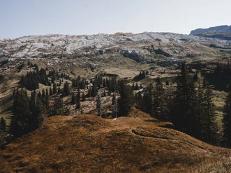
This route starts in Schwarzenbach towards Richliswald and continues to Richliswals until the steep section in the Stäge. This continues westwards in a very steep traverse until Bärensol. This leads to Chlus to Chüebänndli. From Stöllen it goes on to the rocky ridge over the very steep rock-strewn southern ridge to the summit.
- 5:00 h
- 16.31 km
- 1,495 m
- 1,495 m
- 955 m
- 2,450 m
- 1,495 m
- Start: Gasthaus Schwarzenbach
- Destination: Pfannenstock
Good to know
Best to visit
Tour information
Summit
Equipment
Easy climbing therefore ice axe and crampons are helpful.
Directions & Parking facilities
From the Schwyz motorway exit - direction Muotathal and then follow the signs to the Husky Lodge. The Husky Lodge is located about 1 km outside the village. Travel time from the Schwyz motorway exit to Muotathal is about 20 minutes.
There are enough parking spaces available on site.
From SBB Schwyz station by bus of Auto AG Schwyz direction Muotathal.
Bus stop "Muotathal, Hintere Brücke" approx. 15 min walk from the stop along the right bank of the Muota to the Husky Lodge (gravel path starts behind the Sonne restaurant. We recommend a backpack instead of a suitcase) Depending on snow conditions, we recommend walking along the street on the left.
Additional information
For guests at the Husky Lodge mountain hotel to Gasthaus Schwarzenbach, return
Author
Stoos-Muotatal Tourismus
Organization
Stoos-Muotatal Tourismus
Author´s Tip / Recommendation of the author
For the ascent on foot to the summit, an ice axe and crampons can be helpful. Possibly easy climbing (II), depending on conditions.
Safety guidelines
The route leads through the large federal hunting reserve Silberen-Jägern-Bödmerenwald. The route is therefore marked with Stagen from Oberer Schwarzenbach. Please follow the markings!

Nearby