Mythenregion - Circular route Rotenflue - Holzegg - Stägleren - Rotenflue


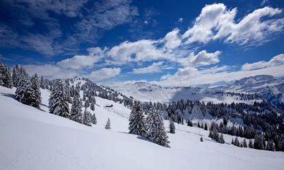
The marked winter hiking trails are varied and also easy to walk for families and seniors. Along the route there are various restaurants to refresh yourself.
- 1:40 h
- 5.04 km
- 229 m
- 229 m
- 1,402 m
- 1,567 m
- 165 m
- Start: Rotenflue cable car mountain station
- Destination: Rotenflue cable car mountain station
Waypoints
Start


Good to know
Pavements
- Unknown (25%)Asphalt (1%)Trail (73%)Path (1%)
Best to visit
- suitableDepends on weather
Directions
- Rotenflue - Holzegg - Stägleren - Rotenflue
Tour information
Circular trail
Familiy-Friendly
Nature highlight
Refreshment stop
Tour with dog
Directions & Parking facilities
- ParkingThere are a few parking spaces at the valley station of the Rotenflue cable car.Public transportationTake the train to Schwyz (Seewen) station, then take the bus to Rickenbach SZ.
Author
Erlebnisregion Mythen
Organization
Erlebnisregion Mythen
Nearby


Download GPX file