Natural history high path Klausen - Brunni valley


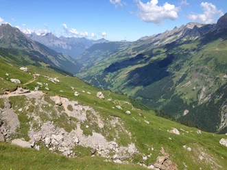
At the very beginning, a slight ascent awaits up to the Alp Chammli. It is worth stopping here to have a coffee and chat with the alpine family about alpine farming. It is also worth buying a bite of the tasty cheese. Above us tower Clariden and Scherhorn. On the opposite side of the valley, the rugged cliffs of the Schächentaler Windgällen rise into the sky. Far in the distance we see Blckenstock, Urirotstock, Gitschen, and Oberbauen.
Soon after the Chammlialp, we soon reach Unter Griess. Here, among the limestone rocks, we find many rare and beautiful flowers: a true splendor. Over the Chammlitritt, we reach the Oberalp. Here, we can admire at the alpine cheese-making museum how cheese has been made on the Uri alpine pastures for centuries. Of course, you can also visit a modern alpine cheese dairy here, buy alpine cheese, or stay overnight when the Oberstafel is grazed.
From the Hienderli, we descend to the Nideralp. From here, it is a comfortable walk on a wide path up to the Wannelen Alp. There are several alpine dairies here and an alpine inn. Those who want can descend by cable car to Unterschächen.
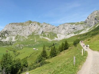
After Wannelen, the path turns south into the picturesque Brunni valley. The rock walls on both sides of the valley are steeply falling. In this rugged nature lies Alp Trogen. We cross open fields and a light forest. Before we descend into the Brunni valley, we pass by Alp Nider Lammerbach.
At the back of the Brunni valley, there is a place to stop. We find barbecue spots and beautiful meadows for a short nap.
We now follow the Hinter Schächen along steep rock walls down to Unterschächen. In the hamlet of Bielen, we pass an old restored wooden sawmill. The Bielen sawmill dates back to the year 1850. It is located at 1140m above sea level. It consists of a two-post simple frame saw and a transmission, which was restored in 1991. The saw is powered by an overshot water wheel with external gear ring. The water supply runs through a wooden channel.
Upon arriving in Unterschächen, we visit the Hotel Alpina to quench our thirst.
- 5:40 h
- 17.14 km
- 309 m
- 1,255 m
- 1,002 m
- 2,060 m
- 1,058 m
- Start: Klausen Pass summit
- Destination: Unterschächen
Good to know
Pavements
- Asphalt (9%)Trail (59%)Path (32%)
Best to visit
- suitableDepends on weather
Directions
- After an impressive post bus ride, we reach the starting point at the Klausen Pass. Below the Chlausenchappeli, the left-side high path begins downhill. Over karst fields and several watercourses, the route first leads to the Chammli. From here, we enjoy the magnificent view over the entire Schächental, down to the Reuss valley and the Urirotstock. From the Chammli, we descend on the partly somewhat exposed path over the Chammlitritt to the Oberalp, further over the Huenderli and along a winding narrow path to the Nideralp. On the well-developed alpine path, the hike continues to Wannelen, Alp Trogen, and Nider Lammerbach. On the newly built alpine access road through dense spruce stands, we reach Brunni. We follow the left side of the valley down to Unterschächen.
Tour information
Culturally interesting
Nature highlight
Refreshment stop
Equipment
- Daypack, good footwear, rain protection, sun protection. In spring and autumn, many alpine inns are not open. Please bring enough to drink then.
Directions & Parking facilities
- Getting thereYou reach Altdorf via the Axenstrasse or the A2. South of Altdorf, you cross a roundabout. Here, you need to turn towards Bürglen, Klausenpass. Then you drive through Bürglen and Spiringen always along the Klausenpass road.ParkingIn Unterschächen, there are a few parking options. However, the number of parking spaces is not very large. You may possibly park your car opposite the Hotel Alpina.Public transportationThe post bus to Linthal is best boarded at Flüelen station. The ride up to the Klausen Pass is impressive. It alone is a unique experience. Of course, you can also take the post bus back from Unterschächen to Flüelen.
Author
Markus Fehlmann
Organization
Verein Urner Wanderwege
Author´s Tip / Recommendation of the author
- Take binoculars with you. On the mountain side, you can spot chamois or maybe deer everywhere.
Safety guidelines
- We need to be careful at two places: at the Chammlitritt and at the Hienderli. However, neither place is really dangerous.
Map
- Urner hiking map sheet "Schächental" (available from the Urner Hiking Association: urnerwanderwege.ch)