Rigi northern flank


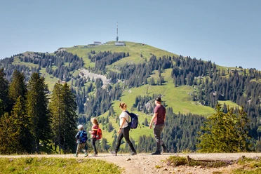
There are certainly easier ways to enjoy the legendary Rigi panorama, but hardly more exciting ones. The path leads through picturesque forests, follows narrow rock ledges, and even squeezes under Nagelfluh overhangs. With increasing altitude, the view opens up over Lake Zug and as far as the Vosges and the Black Forest. After Tristenboden, the alpine key points of the route follow, colloquially called “Füedlibaggen”. Ladders, wire ropes, and iron rungs lead over steep rock passages that would otherwise be inaccessible to the alpine hiker. At Rigi Kulm, you briefly immerse yourself in a colorful tourist bustle before starting the descent to Rigi Dächli.
- 4:35 h
- 11.05 km
- 1,054 m
- 1,054 m
- 743 m
- 1,797 m
- 1,054 m
- Start: Schindlenbäch above Arth
- Destination: Schindlenbäch above Arth
Waypoints
Good to know
Pavements
Best to visit
Tour information
Loop Road
Mountain Railway Tour
Stop at an Inn
Summit
Equipment
Hiking boots with good tread or trekking shoes, rain jacket, drink, food, possibly poles.
Directions & Parking facilities
Driving from the A4 motorway exit, turn left at the Herz Jesu parish church in Goldau and follow the Rigiweg to Schindlenbäch to the hiking signpost in front of the concrete bridge.
On the left side of the road, you will find a gravel parking lot with a small wooden hut. Park the car there.
This route is not easily accessible by public transport. From the Kehlmattli bus stop in Goldau, it is about a 45-minute walk to the starting point of the hike at Schindlenbäch.
Author
Xaver Büeler
Organization
Schwyz Tourismus
Safety guidelines
Children and less experienced mountain hikers should be secured with a climbing rope at the key point. Alternatively, a via ferrata set can also be very helpful.

Nearby


Download GPX file