Saliboden - Innä durä


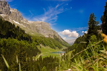
The starting point of the hike is Saliboden. From here, the Glattalp can be reached either on foot or comfortably by cable car. Halfway along the way, on the right, you can admire the Märenbrunnen, a spring high up in the rock.
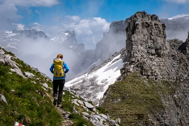
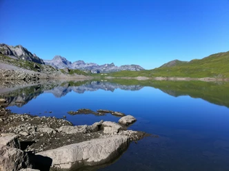
Scenically, the Glattalp is one of the most attractive areas and is known for Siberian temperatures (down to -50° C). Past the chapel and SAC hut, the path leads to Pfaff, a breathtaking viewpoint. The view towards the northeast widens and before us lie the vast plateau of the Charetalp and the wild karst fields around the Pfannenstock. Unlike the Glattalp, where hundreds of cattle are grazed, mainly sheep are encountered on the Charetalp and Brunalpeli. On the Charetalp lies the archaeological abandoned settlement "Spielplätz", investigated in 1982, which dates back to the year 1000.
Now the path leads through primeval karst fields to the highest point of the hike, the Brunalpelihöchi at 2207 m.
- 9:24 h
- 24.98 km
- 2,000 m
- 1,595 m
- 1,137 m
- 2,204 m
- 1,067 m
- Start: Saliboden
- Destination: Pragel Pass Height
Good to know
Pavements
Best to visit
Directions
Tour information
Mountain Railway Tour
Stop at an Inn
Summit
Directions & Parking facilities
By car towards Schwyz and from there to Muotathal. Continue following the signs to Bisistal.
By train to Schwyz station. From there take bus No. 501 to Muotathal.
Additional information
Author
Stoos-Muotatal Tourismus
Organization
Stoos-Muotatal Tourismus

Nearby