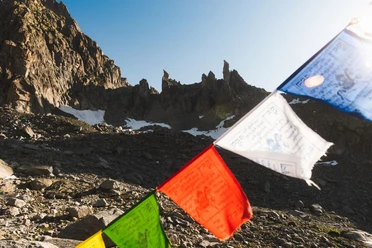
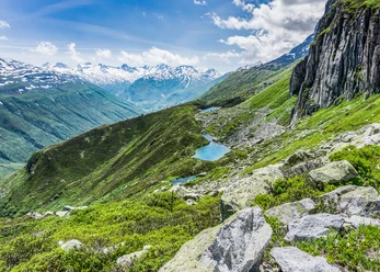
The hiking trail for day-trippers, mountaineers, and rock climbers is short. The hut is also a great destination for families.
From the Furka Pass/Hotel Furkablick (2,427 meters above sea level), five kilometers past the Hotel Tiefenbach, a beautifully maintained trail ascends to a high moor plateau. The scenic trail to the hut begins with a gentle ascent through mountain meadows until it crosses the Sidelenbach stream (2,524 meters above sea level). From there, the trail climbs past the mountain lake (2,674 meters above sea level) over moraines up to the Sidelen Hut. At the foot of the Galenstock at 2,708 meters above sea level, the hut invites you to take a break. With a breathtaking panorama, you’ll enjoy views of the imposing granite walls, glaciers, and rocks in the high-alpine terrain. From the hut, various other routes for hiking, climbing, and mountaineering begin.
- 2:00 h
- 6.03 km
- 276 m
- 276 m
- 2,429 m
- 2,708 m
- 279 m
- Start: Furka Pass Elevation
- Destination: Furka Pass Elevation
Pavements
- Path (100%)
Best to visit
- suitableDepends on weather
Directions
- Furka Pass - Sidelenbach - Mountain Lake - Sidelen Hut
Tour information
Nature highlight
Refreshment stop
Tour with dog
Equipment
- Clothing appropriate for the weather
- Sturdy footwear
- Hiking poles are recommended
- Binoculars
- Camera
- Daypack
Directions & Parking facilities
- Getting thereYou can reach the starting point at the Furka Pass by car via the Furka Pass Road from Realp or Gletsch.ParkingThere is a large parking lot right at the top of the pass.Public transportation
The starting point at the Furka Pass can be reached by PostBus from Realp or Gletsch. The schedule is as follows: PostBus Schedule
Additional information
- For information about the hut, visit: Sidelenhütte SAC
If you have any further questions, please feel free to contact: Andermatt Vacation Region, +41 41 888 71 00, [email protected]
Author
Andermatt-Urserntal Tourismus GmbH
Organization
Région de vacances Andermatt
Author´s Tip / Recommendation of the author
- Popular Climbing Area
- Chamois and marmots
- Mountain lake near the hut
- Climbing area near the lodge
Safety guidelines
- Hikers should check the weather forecast in advance, as the hike takes place at an elevation of over 2,000 meters above sea level and, in extreme cases, light snowfall may occur.
- In general, pay attention to the weather forecasts. Weather conditions in the Alps can change rapidly.