Snowshoe trail Schlittelstübli


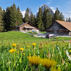
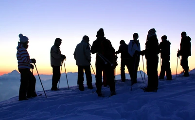
On a 2-3 hour guided tour over snow-covered hills, discover the stunning landscape in the Brunni-Alpthal mountain region. The exciting route is enriched with an apéro during the hike. At the end, enjoy a delicious fondue in the warm Schlittelstübli.
- 0:57 h
- 2.12 km
- 149 m
- 149 m
- 1,049 m
- 1,196 m
- 147 m
- Start: Restaurant Schlittelstübli
- Destination: Restaurant Schlittelstübli
Good to know
Pavements
- Unknown (31%)Trail (69%)
Best to visit
- suitableDepends on weather
Directions
- From the Schlittelstübli restaurant, the cozy winter hiking trail begins downhill towards Eigeli. Just before the main road starts, turn right and hike up through meadows and forests towards Bogenfang. Once you reach the height of Fryfang, turn right and hike back to the Schlittelstübli restaurant.
Tour information
Circular trail
Familiy-Friendly
Refreshment stop
Equipment
- Sturdy footwear and good winter clothing
Directions & Parking facilities
- Getting there
To Alpthal / SZ:
- From the A3 motorway, take exit no. 39 (Schindellegi) from Chur or no. 37 (Richterswil) from Zurich to Biberbrugg. From Biberbrugg continue towards Alpthal.
- From Lucerne, Zug, Schwyz, Gotthard to Schwyz and the canton road no. 8 via Sattel - Rothenthurm - Biberbrugg - Einsiedeln - Alpthal.
ParkingParking is available at the Schlittelstübli parking lot.
Public transportationTake the train to Einsiedeln and then continue by post bus towards Alpthal to the Stei, Alpthal stop.
Additional information
Further information about the Schlittelstübli and its offers can be found here.
Author
Einsiedeln-Ybrig-Zürichsee Tourismus
Organization
Einsiedeln-Ybrig-Zürichsee
Safety guidelines
Avalanche situation:
In case of uncertain snow conditions, we recommend consulting the avalanche bulletin. Every winter sports person is responsible for themselves and uses the official snow routes at their own risk.
Nearby


Download GPX file