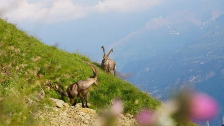
Steinbock-Trek day hike


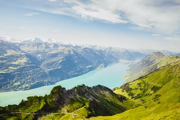
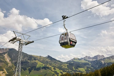
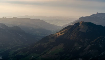
The Rossweid gondola goes from the village of Sörenberg up to Rossweid. From there begins an exciting and varied hike past steep rocks, rugged ridges, scree slopes, and rock-strewn alpine pastures. After the ascent from Rossweid to Lättgässli, it continues along the spectacular ridge hike to the summit of Brienzer Rothorn, where a delightful 360° panorama opens up. Deep down in the valley lies the turquoise blue Lake Brienz, and the nostalgically whistling steam train climbs the mountain from the Bern side. In the background rises the massive, rocky chain of the snow-covered Swiss Alps.
Refresh yourself at the summit restaurant Rothorn, from where the Brienzer Rothorn cable car takes you back down to the valley.
Please observe the following behavior tips:
- Photograph and observe animals only from a safe distance
- Avoid noise, smoke, and other disturbing smells
- Never leave litter in nature; besides harming the environment, waste can become a death trap for animals
- Do not leave the marked trails
- Respect the signage
- 2:55 h
- 5.47 km
- 828 m
- 1,462 m
- 2,290 m
- 828 m
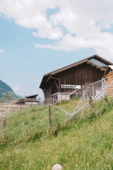
- Start: Sörenberg, Rossweid gondola valley station
- Destination: Descent Brienzer Rothorn cable car
Waypoints
Good to know
Pavements
Best to visit
Directions
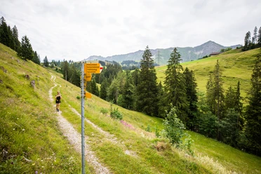
You start in Sörenberg and take the Rossweid gondola to Rossweid. From there, the hike leads towards Blattenegg - Lättgässli - Brienzer Rothorn
From the Rossweid mountain station, it is signed as the "Steinbock-Trek"
Tour information
Mountain Railway Tour
Summit
Equipment
Directions & Parking facilities
The UNESCO Entlebuch Biosphere is located in the heart of Switzerland, centrally between Bern and Lucerne. You reach Sörenberg via main road 10 towards Schüpfheim and from there to Flühli Sörenberg. From Giswil, you drive over the panorama road / Glaubenbielen Pass to Sörenberg.
Plan your route with the help of the Google route planner.
You can reach Sörenberg by public transport via Schüpfheim (Bern-Lucerne railway line). From Schüpfheim, take the post bus to Sörenberg "Post".
Plan your trip with the SBB online timetable.
Additional information
The Steinbock-Trek can also be accomplished as a 2-day hike:
Author
Bergbahnen Sörenberg AG
Organization
UNESCO Biosphäre Entlebuch
Author´s Tip / Recommendation of the author
Safety guidelines

Nearby

Our recommendations