Tannenpfad

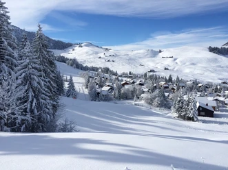
You start directly at the mountain station of the Dallenwil-Wirzweli aerial cableway and walk about 15 minutes to the trail signpost "Tannenpfad". This is located on the left next to the valley station of the Gummenalp aerial cableway. From there, the marked trail runs parallel to the "Arvitrail" until Hinterhegen, where you cross the stream at the Ronemattligraben. A climb follows through the reed and the snow-covered forest to the Ronen area at around 1,500 m above sea level. Then continue to the mountain inn Gummenalp (1,579 m above sea level). Here you can plan a cozy rest for body and soul. If the distance covered is enough for you, take the small 6-person aerial cableway to Eggwald and hike about 15 minutes from the valley station of the Gummen cable car to the starting point Wirzweli. The second option to return to Wirzweli is the trail "Panoramawelt" via Wirzwelihorn. The walking time is about 1.5 hours since the path is walked in reverse, contrary to the trail description below.
- 2:30 h
- 3.53 km
- 352 m
- 14 m
- 1,227 m
- 1,579 m
- 352 m
- Start: Wirzweli
- Destination: Gummenalp
Waypoints
Good to know
Best to visit
Directions
Wirzweli - Gummenmattli - Hinterhegen - Gummenalp
Additional information
Do not leave marked trails: Here you are on the edge of wildlife quiet zones.
Free shuttle bus from Dallenwil station to the valley station of the Wirzweli aerial cableway, shuttle bus registration: +41 41 628 23 94
Author
Nidwalden Tourismus
Organization
Nidwalden Tourismus
Safety guidelines
The paths/trails are used at your own risk. The notices at the valley and mountain stations as well as the current avalanche situation before starting the snowshoe route must be observed.
Nearby