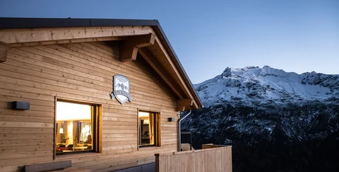
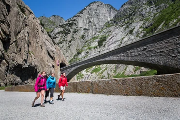
Starting at Teufeltalboden, this varied hike climbs steadily uphill to the Gütsch above Andermatt. The mountain trail winds through alpine meadows, past rock formations, and repeatedly offers impressive views of the Ursern Valley and the surrounding mountains.
As you gain altitude, the panorama widens until you finally reach the Gütsch. A magnificent view awaits you at the top. For the return trip, you can either take the same route or ride comfortably back to Andermatt on the Gütsch-Express.
- 1:15 h
- 2.91 km
- 355 m
- 2 m
- 2,014 m
- 2,369 m
- 355 m
- Start: Teufeltal Valley Floor
- Destination: Gütsch
Pavements
- Unknown (88%)Gravel (6%)Trail (1%)Path (5%)
Best to visit
- suitableDepends on weather
Directions
- Teufeltalboden - Gütsch
Directions & Parking facilities
- Getting thereAndermatt is easily accessible from all directions:
- From the north: via the A2 highway and the Schöllenen Gorge
- From the south: via the A2 and the Schöllenen Gorge or over the Gotthard Pass
- From the east: via the Oberalp Pass
- From the west: via the Furka Pass or using the Furka car ferry
ParkingParking is available in Andermatt.Public transportationAndermatt, the starting point, is easily accessible via the Matterhorn Gotthard Railway. You can find the current schedule at: www.sbb.ch. Author
Andermatt-Urserntal Tourismus GmbH
Organization
Région de vacances Andermatt
Author´s Tip / Recommendation of the author
- Enjoy the view of the Urserntal from the Gütsch, or combine your hike with the Gloria Trail toward Schneehüenerstock.