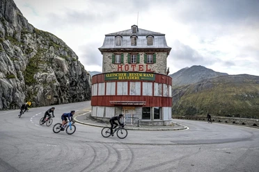
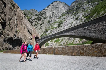
Andermatt-Realp


The hike starts in Andermatt, the largest village in the Ursern Valley. On the sunny side, the valley path leads along the Reuss river, past the golf course to Hospental. Hikers continue through beautiful flower meadows to Zumdorf, the smallest village in Switzerland. Towards Realp, the trail passes through a unique floodplain landscape on the dam of the Furkareuss. In July, the flora along the path is particularly lush. The path is well developed and does not have steep ascents, making it perfect for Sunday walkers.
- 2:40 h
- 9.87 km
- 113 m
- 26 m
- 1,444 m
- 1,538 m
- 94 m
- Start: Andermatt train station
- Destination: Realp train station
Good to know
Pavements
Best to visit
Directions
Tour information
Nature Highlight
Stop at an Inn
Tour with Dog
Equipment
- Weather-appropriate clothing
- Good footwear
- Hiking poles are recommended
Directions & Parking facilities
In summer, Andermatt is very well accessible from all four cardinal directions and is therefore a pleasant starting point.
There is a large parking lot directly behind the train station in Andermatt. It is recommended to park in Andermatt and return from the destination Realp by train.
The starting point Andermatt and the endpoint Realp are very well accessible by train and bus. The timetable is as follows: SBB timetable
Additional information
Author
Andermatt-Urserntal Tourismus GmbH
Organization
Région de vacances Andermatt
Author´s Tip / Recommendation of the author
- Playground in Hospental and Realp including fire pit
- Day backpack/barbecue
- Tower in Hospental
- Zumdorf (smallest village in Switzerland)
- Steinbergen chapel
Safety guidelines
Pay attention to the weather forecasts. In the Alps, the weather can change rapidly.
Nearby


