The Nasentour, Buochs


The tour starts at the Buochs lakeshore to Ennetbürgen. The path then rises slightly to finally reach the outermost point, Unter Nas. Following the ridge between the two arms of the lake, you climb to Rappersfluh and the St. Jost Chapel. Here it is "Enjoy the view!". Varied hike, first along the lake, then to the narrowest point of Lake Lucerne between Ober Nas and Unter Nas. Rappersfluh and the St. Jost Chapel are viewpoints on the return route.
- 4:30 h
- 13.61 km
- 505 m
- 512 m
- 434 m
- 799 m
- 365 m
- Start: Buochs, Post
- Destination: Buochs, Post
Waypoints
Good to know
Pavements
Best to visit
Directions
Buochs – Aawasseregg – Ennetbürgen – Unter Nas – Rappersfluh – St. Jost – Ennetbürgen
Tour information
Loop Road
Nature Highlight
Directions & Parking facilities
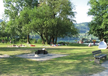
Paid parking lots at the Buochs-Ennetbürgen lakeside bath.
Additional information
For tourist information: Nidwalden Tourism
Author
Nidwalden Tourismus
Organization
Nidwalden Tourismus
Author´s Tip / Recommendation of the author
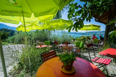
For those still looking for a restaurant to stop at: The Hotel Sternen in Buochs conjures up homemade, fine dishes and specialties again and again from fresh market and regional products.
Nearby


Download GPX file