Unterägeri – Gottschalkenberg – Unterägeri

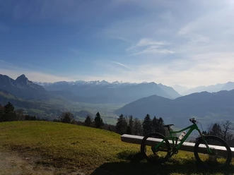
Start is in Unterägeri. Along the main road the route leads to Oberägeri and then pleasantly uphill to the Raten restaurant. The last ascent is a bit steeper. Afterwards it continues flat along the height to the Gottschalkenberg restaurant. Here a detour to the Bellvue viewpoint is recommended, where there is a nice view over Lake Zurich.
Then continue up a short and steep trail to the start of the actual descent. This is very flowing. In between there are short uphill sections. In good weather many pedestrians are on the trail.
- 2:05 h
- 19.56 km
- 523 m
- 524 m
- 725 m
- 1,163 m
- 438 m
- Start: Unterägeri
- Destination: Unterägeri
Good to know
Pavements
Unknown (1%)
Street (19%)
Asphalt (41%)
Gravel (4%)
Trail (27%)
Path (8%)
Best to visit
suitable
Depends on weather
Directions
Unterägeri - Oberägeri - Raten - Gottschalkenberg - Unterägeri
Tour information
Loop Road
Equipment
- Full mountain bike
- Route is very well suited for e-mountain bikes
Directions & Parking facilities
In Unterägeri paid parking spaces are available by the lake.
Author
Marc Schürmann
Organization
allmountain
Safety guidelines
On weekends and in good weather many pedestrians are on the trail.

Nearby
Download GPX file