WanderWunder Schwyz: Rotenflue via Zwüschet-Mythen to Brunni


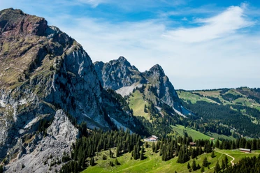
The Rotenfluebahn brings pleasure hikers to the starting point. Enjoyment is encountered on the way in several forms. First to mention is the panorama: repeatedly the view opens down to the Schwyz basin and Lake Lucerne, but also to the surrounding mountain peaks. On the section between the Rotenflue and Zwüschet-Mythen, hungry and thirsty hikers find various cozy mountain restaurants. In addition, the route here runs slightly downhill.
The Great Mythen, a huge limestone block, repeatedly comes into view. Its red tip is particularly clearly visible from this distance. The reddish rock was deposited about 200 million years ago in a former ocean in the area of Italy and Spain. Later it was pushed over the Gotthard towards the north and got stuck at the 50 million years young Mythen.
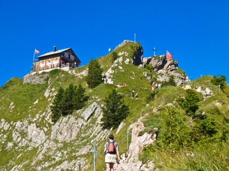
Many wild animals live in the Mythen reserve. They have been protected since 1875. Respectful hikers who keep their eyes and senses open discover chamois, red deer, marmots, field hares, or capercaillies.
Variant 1
Hike Rotenflue – Holzegg – Zwüschet-Mythen – Brunni – cable car ride Brunni-Holzegg – Rotenflue
Variant 2
Hike Rotenflue – Holzegg – Zwüschet-Mythen – Brunni – Holzegg – Rotenflue
Variant 3
Hike Rotenflue – Holzegg – Zwüschet-Mythen – Brunni – by post bus to Einsiedeln station
- 2:10 h
- 6.98 km
- 471 m
- 471 m
- 1,100 m
- 1,571 m
- 471 m
- Start: Rotenflue
- Destination: Rotenflue
Good to know
Pavements
Best to visit
Tour information
Loop Road
Nature Highlight
Directions & Parking facilities
Author
Schwyzer Wanderwege
Organization
Schwyzer Wanderwege
Nearby


Download GPX file