Winter hiking trail little Melchaa gorge


- 4:09 h
- 13.39 km
- 511 m
- 511 m
- 468 m
- 967 m
- 499 m
- Start: Giswil station
- Destination: Giswil station
The hike leads from Giswil station to the northern end of the village and further to the Zollhaus inn.
Through the south exit of the motorway tunnel, you reach Tobelsträsschen. Follow it uphill until it bends into the narrow gorge. Deep below, the water of the little Melchaa rushes, squeezing through narrow rock basins. At Cholplatz, there is a shelter and a board that informs about the interesting locations and stories you pass in the gorge one after another: Bettlernest, Dom, Giswiler Hüttli Lochcheller, Tuffgräben, Lengbrügg up to the endpoint 977 of the winter hike at Rindenhüttli.
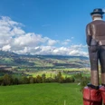
Here the path branches and leads further up in summer to the center of Switzerland at Älggi. The winter hike returns the same way out of the gorge and down through the Grossmattwald forest; also a popular sledding trail - to Zollhaus and under the road to the lakeside path. Southwards, you return along the little Melchaa, which was diverted directly into Lake Sarnen in 2015, back to Giswil. As an alternative, you can also hike northwards on the lakeside path to Ewil Maxon station or to Sachseln.
Good to know
Pavements
Best to visit
Tour information
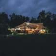
Stop at an Inn
Directions & Parking facilities
From Lucerne on the A2, change in the tunnel to the A8 towards Interlaken, Sarnen, and follow the road to the Giswil exit.
From Interlaken via Brünig on the A8 to the Giswil exit.
Author
Obwalden Tourismus
Organization
Obwalden Tourismus
Safety guidelines
Current information about closures, e.g. for logging, is available at www.ow-wanderwege.ch
The path is not secured against hazards such as falling icicles. Use at your own risk!
This hike is not marked with pink signs and is not maintained.
Nearby