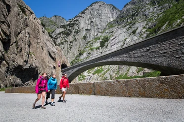
5-hut panorama route: stage 1 from Göschenen to Dammahütte SAC


Starting in Göschenen, you leisurely hike through the Göschenertal Alp past green meadows, rest areas, woodland, and along the river. After the hike from Göschenen up to the dam, the southern route begins towards the Dammahütte. It is the shorter route in terms of time and distance. The hiking trail runs south of the Göschenertal Alp lake, along the slopes and meadows of Älpergen and Höhenberg. Early risers can enjoy the morning shade on the first half of the trail, from the dam to the Dammareuss bridge. This is a great spot for a well-deserved rest. At the bridge, the southern and northern routes meet. From this junction, the direct path first goes somewhat steeper over stone steps and rocky fields to Dammastäfeli and up to the Dammahütte. The Dammahütte lies at the foot of the Damma range with the Dammastock, the highest mountain in the canton of Uri at 3637 m above sea level, at the end of the Göschenertal valley.
- 5:10 h
- 13.42 km
- 1,416 m
- 84 m
- 1,106 m
- 2,438 m
- 1,332 m
- Start: Göschenen Train Station
- Destination: Dammahütte SAC
Good to know
Pavements
Best to visit
Directions
Göschenen - Göschenertal Alp - Göschenertal Alp Reservoir - Dammahütte SAC
Tour information
Nature Highlight
Stop at an Inn
Equipment
- Clothing appropriate for the weather
- Good footwear
- Trekking poles are recommended
- Via ferrata set required (entire 5-hut route)
Directions & Parking facilities
Göschenen is directly accessible via the A2 motorway and is therefore very easy to reach.
There are many parking options at the Göschenen train station and in the village near the Coop.
Göschenen is very well connected from various directions and is the junction between the Matterhorn Gotthard Bahn (MGB) and the SBB. The timetable is as follows: SBB Timetable
Additional information
- Information about the hut can be found here: Dammahütte SAC
For further questions, feel free to contact: Andermatt Holiday Region, +41 41 888 71 00, [email protected]
Author
Andermatt-Urserntal Tourismus GmbH
Organization
Région de vacances Andermatt
Author´s Tip / Recommendation of the author
- Buy local products at the shop in the Berggasthaus Dammagletscher.
- A visit to the Geissenparadies is worthwhile for those interested.
Safety guidelines
Hikers should keep an eye on the weather forecast in advance, as parts of the hike are over 2000 m above sea level and, in extreme cases, light snowfall may occur.

Nearby


