Vermigel Hut SAC


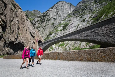
The hike starts at the Andermatt train station and leads first to the roundabout near the Coop and the bakery. From there, take the Oberalpstrasse up to the Wyler district. A few meters past the chapel, an alpine road branches off to the right. Follow this road through the wild and romantic Unteralp valley until you reach the Vermigel Hut. Along the way, you’ll pass lush meadows, the Unteralpreuss stream, and several other streams. After a break at the Vermigel Hut, head back to Andermatt along the same route.
However, the Vermigel Hut can also be reached via other well-maintained hiking trails. Situated at 2,042 meters above sea level at the very back of the Unteralp Valley, this small and cozy SAC lodge delights families, hikers, and, in winter, ski tourers alike. Located on the “Sunnsbiel” viewing terrace, the hut serves as a starting point for a variety of rewarding hikes as well as numerous popular biking, snowshoeing, and ski touring routes along the main Alpine ridge, and is a stop on the Four Sources Trail.
- 5:15 h
- 16.30 km
- 674 m
- 674 m
- 1,436 m
- 2,042 m
- 606 m
- Start: Andermatt Train Station
- Destination: Andermatt Train Station
Good to know
Pavements
- Street (2%)Asphalt (12%)Gravel (44%)Trail (14%)Path (28%)
Best to visit
- suitableDepends on weather
Directions
- From the Andermatt train station, follow the road into the village. Between the Spycher and Sternen restaurants, hikers climb a narrow staircase (Staltenweg) up to Oberalpstrasse, which they follow for a short distance. At the Chuchichästli restaurant, an alpine road closed to vehicles branches off to the right (hiking sign). Hikers follow this road—which is paved at the beginning—for about three hours through the wild and romantic Unteralptal valley, constantly accompanied by the Unteralpreuss River. It is not until toward the end of the hike, on the Vermigel plateau, that you can see the destination for this stage. You cross the Reuss River on a bridge near the old hut, and after one final climb, you reach the hut.
Tour information
Nature highlight
Refreshment stop
Tour with dog
Equipment
- Clothing appropriate for the weather
- Sturdy shoes
- Binoculars
- Camera
- Daypack
Directions & Parking facilities
- Getting thereIn the summer, Andermatt is very easy to reach from all four directions, making it a pleasant starting point.Parking
There is a large parking lot in Andermatt, right behind the train station. It is located right at the starting point of the route.
Public transportationAndermatt is a junction for the Matterhorn Gotthard Railway and is therefore very easily accessible by train. The schedule is as follows: SBB Schedule
Additional information
Author
Andermatt-Urserntal Tourismus GmbH
Organization
Région de vacances Andermatt
Author´s Tip / Recommendation of the author
- On the lookout for marmots.
- The first part, in particular, is easily accessible with a stroller
- Alpine roses in June
- Accessible by car (driver’s license required)
Safety guidelines
- Due to mudslides, the hiking trails and the road to Unteralp are closed until further notice. Unteralp is currently inaccessible. Please observe the on-site closures and take alternative routes.