Aaschlucht-Lutersee-Engelberg


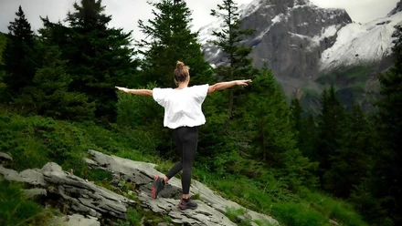
A wonderful and varied day route. The path down along the Aaschlucht is easy to manage. The path from Ruggisbalm back to Engelberg is more demanding.
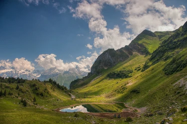
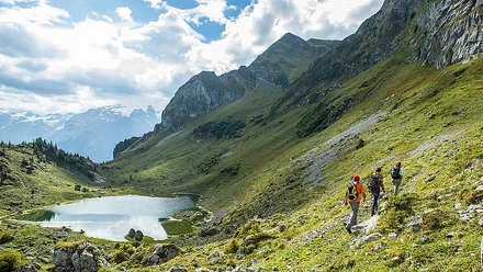
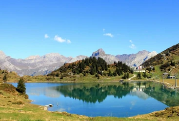
Starting from Engelberg, you first hike through the wildly romantic Aaschlucht down into the valley. From Grafenort, there is an enjoyable descent to the Buiräbähnli Mettlen-Ruggisbalm-Lutersee, which comfortably takes you up in altitude. From Ruggisbalm you go to the idyllic Lutersee and then back to Engelberg through meadows and forests. The hike can also be done in reverse.
- 7:20 h
- 16.91 km
- 1,245 m
- 1,234 m
- 592 m
- 1,750 m
- 1,158 m
- Start: Eugenisee Engelberg
- Destination: Eugenisee Engelberg
Waypoints
Good to know
Pavements
Best to visit
Directions
The path from Engelberg down along the Aaschlucht is easy to manage. Various picnic spots along the entire Aaschlucht invite you to linger. Upon arriving in Grafenort, take the 1st Buiräbähnli, which takes you from Mettlen to Ruggisbalm. Then continue with another Buiräbähnli up to Eggendössli. From there, the more demanding hike to Lutersee and back to Engelberg begins. Between Lutersee and Engelberg, you have the opportunity to take a break at Alp Zingel.
Tour information
Loop Road
Stop at an Inn
Equipment
Directions & Parking facilities
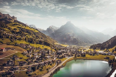
By car, drive on the A2 (Basel-Gotthard) to Stans Süd, then take the main road 20 km to Engelberg. Engelberg is 30 minutes from Lucerne, 1 hour and 15 minutes from Basel, Zurich or Bern.
Car parks are available in Engelberg for a fee.
Additional information
It is also possible to do just the Aaschlucht hike or the 1st stage of the Buiräbähnli Safari. This is a combined route of these two hikes.
Aaschlucht hike: www.engelberg.ch/aaschlucht
Buiräbähnli Safari 1st stage: www.engelberg.ch/buiräbähnli
All hiking trails in and around Engelberg:
Author
Engelberg - Titlis Tourismus
Organization
Engelberg-Titlis Tourismus
Author´s Tip / Recommendation of the author
Safety guidelines
Storm event: Crossing between the Aaschlucht and Schändliloch towards Obermatt and vice versa is not possible for hikers! Please use the existing detour.

Nearby


Download GPX file