Ahorn - Napf - Luthern Bad


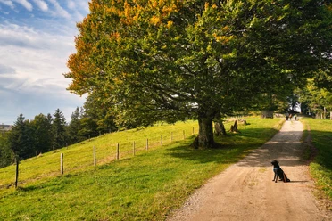
The path is well signposted along the border trail “Schweiz Mobil Route 65” over hill chains to the 1406 m high summit. Various rest areas invite you to picnic along the way. From the Napf, there is a magnificent panoramic view of the Alps, the Jura, and the Swiss Plateau. The path leads steeply via Trachselegg to Luthern Bad, from where we take the post bus to Zell, where we change to the train.
- 4:50 h
- 14.76 km
- 535 m
- 799 m
- 874 m
- 1,405 m
- 531 m
- Start: Ahorn
- Destination: Luthern Bad
Good to know
Best to visit
Directions
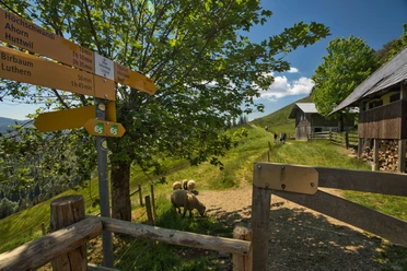
The route is excellently signposted; follow the signs "Grenzpfad Napfbergland 65" towards Napf.
From the Napf, the route descends via Trachselegg to Luthern Bad.
Tour information
Stop at an Inn
Equipment
- Weather-appropriate clothing
- Good footwear
- Hiking poles are recommended
- Camera
- Day backpack
Directions & Parking facilities
With the hiking bus from Huttwil to Ahorn
From Luthern Bad by post bus to Zell or Hüswil
Additional information
A visit to the Arm and Foot Bath in Luthern Bad is worthwhile
For the experience report with insider information.
Author
Anna Rey
Organization
Willisau Tourismus
Author´s Tip / Recommendation of the author
- From May 1 to October 31, on Saturdays, Sundays, and public holidays, the hiking bus runs; advance booking is necessary
- The route can also be ended at Menzberg, Hübeli near Hergiswil, or Holzwegen; check the bus schedule!
Nearby
