Andermatt - Hospental


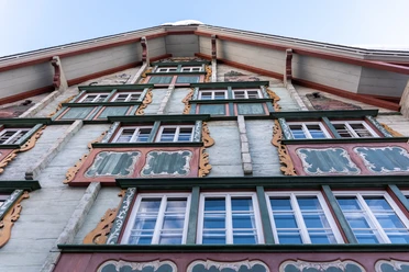
The hike from Andermatt to Hospental follows the valley floor along the Reuss River through the open valley of the Urserntal. Passing blooming meadows and the golf course, you’ll reach the historic village of Hospental with its striking residential tower and well-preserved traditional houses.
The well-maintained trail has no major inclines and is ideal for a leisurely stroll or a short hike. Along the way, you’ll enjoy beautiful views of the surrounding mountains and the wide valley floor of the Ursern Valley.
- 0:55 h
- 3.51 km
- 25 m
- 6 m
- 1,429 m
- 1,453 m
- 24 m
Good to know
Pavements
- Street (15%)Asphalt (9%)Gravel (9%)Trail (65%)Path (2%)
Best to visit
- suitableDepends on weather
Tour information
Nature highlight
Refreshment stop
Tour with dog
Directions & Parking facilities
- Getting thereIn the summer, Andermatt and Hospental are very easily accessible from all four directions, making them a pleasant starting point.ParkingParking is available in Andermatt.Public transportationBoth the starting point, Andermatt, and the endpoint, Hospental, are very easily accessible by train and bus. The schedule is as follows: SBB Schedule
Author
Andermatt-Urserntal Tourismus GmbH
Organization
Région de vacances Andermatt
Author´s Tip / Recommendation of the author
Tower in Hospental
Zumdorf (Switzerland's smallest village)