Arvigrat


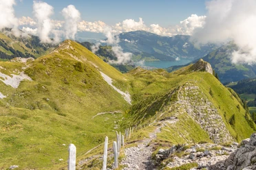
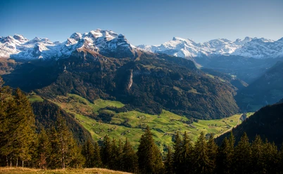
The historic Ächerli Pass has given and still gives rise to various speculations and teasing between the people of Nidwalden and Obwalden, which originate from Napoleon's French invasion of Nidwalden in 1798. It is the starting point of a scenic circular hike. From point 1427, the mountain trail leads over the Alp Chieneren up to the Arvigrat. A varied natural landscape with a wide variety of flowers and rich in butterflies amazes the hikers. Always staying on the ridge, which forms the border between Obwalden and Nidwalden, heading south, you reach the highest point of the Arvigrat at 2014 m above sea level. A magnificent panoramic view offers deep views into the Engelberg and Sarneraa valleys as well as distant views of the Pre-Alps and Alpine ranges. This view extends over the Nidwalden, Engelberg, and Obwalden peaks far into the Bernese and Vaud Alps and even to the Jura.
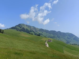
Instead of continuing the hiking trail southwards, one follows a short distance back and descends westwards over trail traces directly to the mighty Arvi Cross, which, together with the opposite Pilatus, towers over the Sarneraa valley. The trail traces then continue to the Arvi hut. Back on the mountain trail, descending through open woods and alpine pastures, past the Heitletsboden forest reserve, one reaches Alp Scharti and from there follows the pass road back to the starting point Ächerli.
- 3:03 h
- 7.78 km
- 609 m
- 609 m
- 1,400 m
- 2,009 m
- 609 m
Good to know
Best to visit
Tour information
Loop Road
Directions & Parking facilities
Author
Obwalden Tourismus
Organization
Lucerne Tourisme

Nearby

Download GPX file