Circular route around Schwändi near Entlebuch


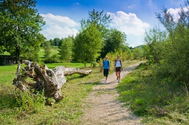
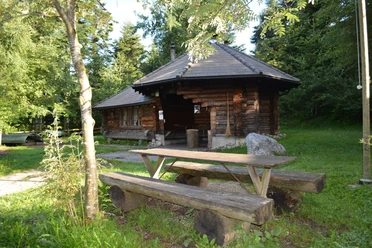
This easy circular hike takes you over roots and stones, mostly on forest paths. The path leads around the Schwändi neighborhood and is marked with charming wooden plaques. After a short time, a beautiful pond is located a few meters off the path (southwestern edge of the settlement). Above the pond there is a public picnic area.
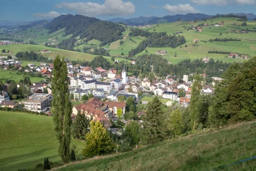
Especially beautiful is the view from Bitzisegg over the entire valley. In the vegetation-free period (autumn to spring), the variant via Brachweid–Obwidehof can be hiked, which offers a wonderful panoramic view up to Säntis.
- 0:55 h
- 2.06 km
- 129 m
- 129 m
- 900 m
- 1,030 m
- 130 m
- Start: Schwändi settlement
- Destination: Schwändi settlement
Good to know
Best to visit
Directions
Observe the signage (wooden plaques) on site.
Tour information
Familiy-Friendly
Loop Road
Tour with Dog
Equipment
Good footwear, rain jacket & enough drinking water for the trip are essential for every hike.
Further tips for safe hiking, information on suckler cow herds and livestock guardian dogs, and much more are available on the Swiss Hiking Trails website.
Directions & Parking facilities
The UNESCO Entlebuch Biosphere is located in the heart of Switzerland, centrally between Bern and Lucerne. You can reach Schwändi via the main road 10 towards Entlebuch and from there towards Rengg. Don’t miss the Schwändi turnoff.
Plan your route using the Google route planner.
Free parking spaces for two cars at the mailbox facility.
Not directly accessible by public transport.
Additional information
Literature
Author
UNESCO Biosphäre Entlebuch
Organization
UNESCO Biosphäre Entlebuch
Author´s Tip / Recommendation of the author
Beautiful view at Bitzisegg.
Nearby

Download GPX file