Circular hike Willisau - Mörisegg - Hergiswil


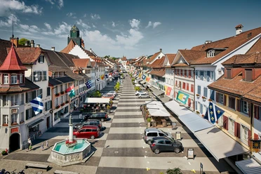
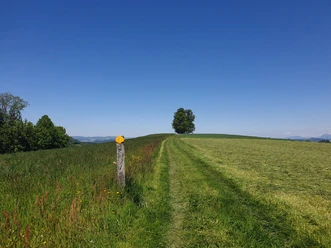
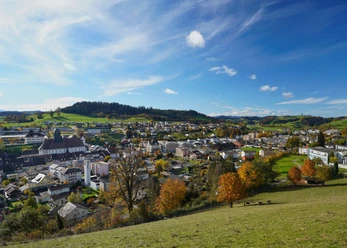
The hike begins in the historic old town of Willisau. The path leads steeply uphill, past the Landvogt castle to Vorberg. The strenuous ascent is rewarded with a magnificent view. From there, the comfortable hiking trail leads over the broad ridge between the Enzi- and Buechwigger to Mörisegg. Lindenegg is the highest point of this hike. Afterwards, you hike down into the herb village of Hergiswil. The herb village earns its name from the herb cultivation that has been maintained for about 20 years. What started as pioneering work has now become an indispensable source of income for agriculture. Who knows, perhaps this hike passes by a fragrant herb field. From Hergiswil, you walk along the gentle Enziwigger back to Willisau.
- 4:13 h
- 15.10 km
- 250 m
- 250 m
- 554 m
- 804 m
- 250 m
- Start: Willisau train station
- Destination: Willisau train station
Waypoints
Good to know
Pavements
- Asphalt (27%)Trail (61%)Path (12%)
Best to visit
- suitableDepends on weather
Directions
Willisau - Vorberg - Mörisegg - Lindenegg - Hergiswil - Breiten - Willisau
Tour information
Circular trail
Refreshment stop
Equipment
- Weather-appropriate clothing
- Good footwear
- Hiking sticks are recommended
- Camera
- Daypack
Directions & Parking facilities
- ParkingPaid parking spaces at Willisau train stationPublic transportationBy train to Willisau. From Hergiswil the post bus runs.
Additional information
Author
Willisau Tourismus
Organization
Willisau Tourismus
Author´s Tip / Recommendation of the author
- Fireplace Blöömatte
- Playground Breiten with barbecue area and toilets
- Return from Hergiswil by post bus
Nearby






Download GPX file