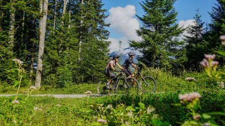
Cycling route Pragel - Klausen Pass


From Flüelen, we follow Lake Uri. We can take it easy and start slowly. From Brunnen, the route follows various side roads, and the terrain rises gently. Only in Schwyz, at the entrance to the Muothatal, does it start going uphill for the first time. But soon (from kilometer 20 to kilometer 30) it levels out again. After the first 30 kilometers comes the first climb. The Pragel Pass is mostly car-free and therefore a special delight for cyclists. The gradient reaches up to 18%. The landscape becomes wilder and we approach the tree line. At kilometer 40, we cross the first pass, the Pragel Pass, 1548 meters above sea level.
The first descent through the Klöntal, along the Klöntalersee, is a first reward. A unique landscape with a unique lake. After about 60 kilometers, we reach Glarus. Now come 20 kilometers into the Glarus region. It hardly rises, but the route feels long until we reach Linthal.
Now comes the longest climb. Initially from 650 meters above sea level to around 1350 meters above sea level at Urnerboden. In summer, the largest alpine cattle pasture in Switzerland grazes livestock. It is open grazing, and occasionally some cows can block the road. For about 5 kilometers, we can rest a little before the final climb towards Klausen Pass. The pass height is 1948 meters above sea level. For many cyclists, the Klausen Pass is their favorite pass. It offers a lot of variety.
Now the descent follows. Beat Breu managed the climb from Altdorf to Klausen Pass in 55 minutes during a time trial at the 1984 Tour de Suisse. We take the opposite way and will enjoy the descent through the beautiful Schächental. Going downhill, we will take longer than Beat Breu needed going uphill. Until Flüelen, we cover 1500 meters of elevation.
Tired but satisfied, we reach Flüelen, the starting point of the route.
- 11:39 h
- 130.23 km
- 3,176 m
- 3,177 m
- 434 m
- 1,947 m
- 1,513 m
- Start: Flüelen train station
- Destination: Flüelen train station
Good to know
Best to visit
Tour information
Loop Road
Stop at an Inn
Author
Markus Fehlmann
Organization
Verein Urner Wanderwege
Author´s Tip / Recommendation of the author
Nearby


Download GPX file