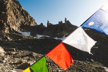
Hike from source to source and spend the night right along the route: The Four Sources Trail in the Gotthard region lets you explore the area where four rivers originate in five daily stages. Experience the “Water Castle” and the European watershed on the Four Sources Trail. In the legendary Gotthard Massif, you’ll hike to the four sources of the Rhine, Reuss, Ticino, and Rhône, which flow in all four cardinal directions. The alpine hiking trail is divided into five day stages.
The fifth and final stage of this multi-day hike leads from Obergoms to the source of the Rhone. The stage leads from Obergesteln via Oberwald, Gletsch, and Muttbach up to the Furka Pass and from there to a viewpoint overlooking the Rhone Glacier. We view the source of the Rhone from a distance.
- 7:15 h
- 16.72 km
- 1,309 m
- 238 m
- 1,353 m
- 2,476 m
- 1,123 m
- Start: Obergesteln
- Destination: Belvédère
Pavements
- Street (14%)Trail (21%)Path (65%)
Best to visit
- suitableDepends on weather
Directions
- Obergesteln (1,355 m) – Oberwald (1,368 m) – St. Nikolaus Chapel (1,550 m) – Gletsch, Steam Train Station (1,757 m) – Muttbach Station (2,170 m) – Furka Pass (2,429 m) – Belvédère bus stop (2,271 m)
Tour information
Nature highlight
Refreshment stop
Tour with dog
Equipment
- Clothing appropriate for the weather
- Sturdy footwear
- Hiking poles are recommended
Directions & Parking facilities
- Getting there
If you plan to complete the entire hike, including all 5 stages, it is recommended that you drive to Andermatt or the surrounding area. Andermatt is very easily accessible from all four directions in the summer and is therefore a pleasant starting point.
If you’d like to do just this stage, take a trip to Obergoms.
ParkingIn Andermatt, right behind the train station, there is a large parking lot. It’s only about a 10-minute walk from the starting point of the route.
In Obergoms, there are parking lots in various locations, depending on where you want to start.
Public transportationYou can reach Obergesteln by the Matterhorn-Gotthard Railway or by PostBus.
From the Belvedère stop, take the PostBus toward the cantons of Valais or Uri.
The schedules are as follows: SBB Schedule
Additional information
- For a good night’s rest, you’ll find rustic mountain huts right along the trail or cozy hotels in the nearby villages. For leisure hikers, Eurotrek offers a four-day package that includes luggage transport. Recharge your energy in the mineral-rich mountain landscape. Leave your everyday life behind and enjoy the unique cultural and natural diversity in the heart of the Swiss Alps. Please note that the Vermigel Hut is very popular during peak season. If the hut is fully booked, we recommend alternative routes.
Author
Andermatt-Urserntal Tourismus GmbH
Organization
Région de vacances Andermatt
Author´s Tip / Recommendation of the author
- The hike can also start from Oberwald or Ulrichen
- A detailed hiking map, including information, can be purchased at the Tourist Information office.
Safety guidelines
- Hikers should check the weather forecast in advance, as parts of the hike are at an elevation of over 2,000 meters above sea level, and light snowfall is possible in extreme cases.
Please also note that the Furka Pass is closed during the winter months, so the PostBus does not operate there either. For information on the pass’s opening status, visit: Alpine Passes