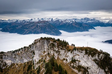
From Gersau to Rigi Hochflue


The hike leads over Mettlen up to Ochsenalp with an impressive view over the lake and Gersau. Then it continues to Alp Zillistock. Depending on the time of day, chamois graze there.
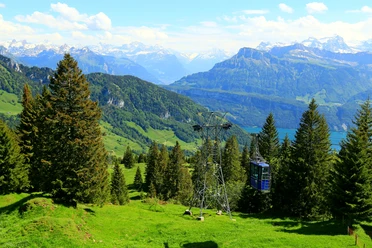
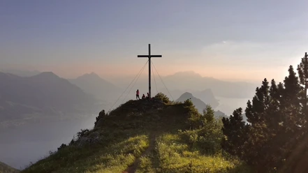
Soon after, the blue-white alpine trail to Hochflue begins. This trail leads over warm rock walls, on which ropes and chains are mounted for holding on. At the top of the mountain peak, the view is - how else can I say it - otherworldly. The sight of the Alpine range combined with the turquoise-colored Lake Lucerne far below is unique.
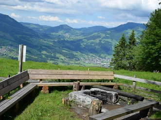
The descent is spectacular from the start: We climb down a ladder about 17 meters long vertically. From there it goes steadily downhill until the restaurant Gätterlipass. A cool drink on the terrace rounds off the experience. From there, it’s just a stone’s throw to Ober Gschwend.
But the adventure is not over yet: Bus 535 takes us on an impressive route back from Ober Gschwend to Gersau.
- 4:55 h
- 8.85 km
- 1,264 m
- 687 m
- 435 m
- 1,699 m
- 1,264 m
- Start: Gersau
- Destination: Gersau
Good to know
Pavements
Best to visit
Directions
Gersau (435m) - Ochsenalp (1053m) - Hochflue (1699m) - Gätterli (1190m) - Ober Gschwend (1006m)
Tour information
Climbing Site
Loop Road
Mountain Railway Tour
Nature Highlight
Stop at an Inn
Summit
Equipment
Sturdy footwear and weather-appropriate clothing recommended.
Directions & Parking facilities
Via motorway A4: exit Küssnacht am Rigi or exit Brunnen towards Gersau.
However, we recommend public transport instead of a car: lean back, enjoy and do something good for the environment at the same time.
In the village there are various paid parking options: e.g. at the quay area by the lake, in the middle of the village at the Old Town Hall or a bit higher up in the village at the Silk Factory. Payment by app is possible everywhere.
Timetable for bus line 535 (Ober Gschwend - Gersau) and/or bus connections to Brunnen or Küssnacht: sbb.ch
Gersau is also reachable by boat! SGV/timetable
Additional information
Gersau hiking map: gersautourismus.ch
Author
Gersau Tourismus
Organization
Schwyzer Wanderwege
Author´s Tip / Recommendation of the author
So that future generations or tomorrow's hikers can enjoy the trail, we ask you to take your trash back with you.
Safety guidelines
Snowfields still possible in May! The trail is not to be underestimated. Hike with concentration at tricky spots.
Map
Nearby
Download GPX file