Gätterli hike


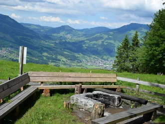
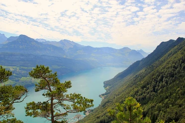
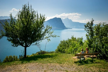
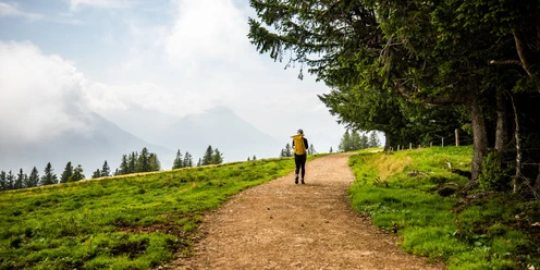
The hike starts with a slight incline at the Urmiberg cable car top station. It continues uphill to Gätterli, where you can enjoy breathtaking views of Lake Lucerne and the surrounding mountains. Treat yourself to a break at the Gätterlipass restaurant. Afterwards, it goes steeply downhill to Bärfallen and further down to the Urmiberg valley station.
- 4:05 h
- 10.18 km
- 596 m
- 1,296 m
- 436 m
- 1,474 m
- 1,038 m
- Start: Urmiberg top station
- Destination: Urmiberg valley station
Waypoints
Good to know
Pavements
Best to visit
Directions
Tour information
Mountain Railway Tour
Stop at an Inn
Summit
Equipment
Directions & Parking facilities
Muotaplatz
Muota parking lot rates: 1h free / 2h CHF 0.50 / 3h CHF 1.00 / 4h CHF 2.00 / 5h CHF 3.00 / 6h CHF 4.00 / 7h - 24h CHF 5.00 from 25h, each additional hour CHF +0.20 no parking restrictions.
Take the train to Brunnen station, then take bus line 502 and get off at the Brunnen, Urmiberg cable car stop.
The departure times from Brunnen station can be found here.
Additional information
Information on the timetable of the Urmiberg aerial cable car can be found here.
Author
Erlebnisregion Mythen
Organization
Schwyzer Wanderwege
Nearby


