Gotthard Bike: Stage 1 Andermatt - Airolo


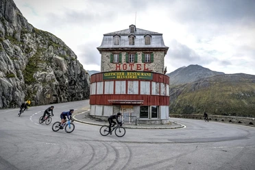
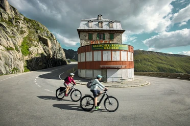
The Gottardo Bike route combines impressive, high alpine landscapes with a detailed lesson in Swiss history. The Gotthard Pass has been one of the most important north-south connections for centuries. During World War II, it also gained military significance. Large sections of the route were originally military access roads.
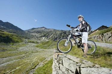
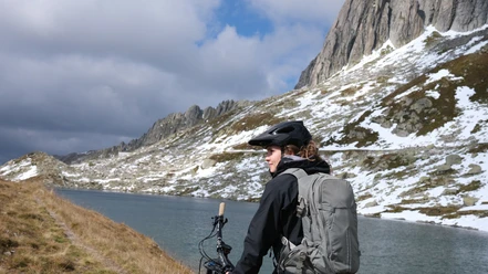
The route starts in Andermatt and leads over Hospental up the Gotthard Pass. The ride then continues uphill towards Sellasee. Shortly before Sellasee, a path branches off to the right and up. At the top, you can enjoy a fantastic view of the surrounding mountain ranges and down to Airolo. On the field road, you then tackle the descent down to Airolo.
- 3:40 h
- 30.20 km
- 882 m
- 1,176 m
- 1,116 m
- 2,235 m
- 1,119 m
- Start: Andermatt train station
- Destination: Airolo train station
Good to know
Pavements
Best to visit
Directions
Andermatt - Gotthard Pass - Airolo
Tour information
Nature Highlight
Stop at an Inn
Equipment
- Clothing suitable for the weather
- Light
Directions & Parking facilities
In summer, Andermatt is very well accessible from all four cardinal directions and is therefore a pleasant starting point.
In Andermatt, there is a large parking lot directly behind the train station.
Andermatt is the connection point of the Matterhorn Gotthard Railway and is therefore very well accessible by train. The destination Airolo is also well connected by bus and train. The timetable is as follows: SBB timetable
Additional information
Author
Andermatt-Urserntal Tourismus GmbH
Organization
Région de vacances Andermatt
Author´s Tip / Recommendation of the author
- Sasso San Gottardo
- National St. Gotthard Museum
Safety guidelines
- Observe the opening hours of the Gotthard Pass road (winter closure)
Nearby

