Bike route Schöllenen - Stöckli - Riental


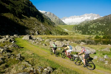
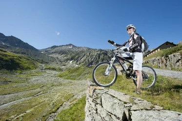
The bike route to Stöckli starts in Göschenen. Up to the Häderlisbrücke in the Schöllenen Gorge, the route follows the main road; there you switch to the other side of the valley onto a narrow, quite steep path. It is partially laid on the roof of the gallery and allows avoidance of traffic. At Brüggwald, the main road is crossed, where the old packhorse road is an alternative to the main road. After the Devil’s Bridge, you pass through the Urnerloch to Andermatt, where the Oberalp pass road leads to Nätschen. From there, you ride on a natural road to Gütsch and further up to Stöckli, where a fantastic view of the mountains opens up. Worthwhile addition: below Stöckli, there is a mostly flat path to Lutersee, which is suitable for a rest. The descent through the Riental is very difficult and should only be attempted under dry conditions. It starts at the top 180-degree curve below Stöckli; the entrance to the trail is seen from above on the right side of the military cable car. Down to Göschenen, over 1300 meters of elevation must be overcome, with the upper part mostly covered with grass, while further down gravel and rock slabs also appear. In the lowest part, the bike often has to be pushed — because of scree, high steps, or yawning chasms. The trail ends at the siding of Göschenen station, near Steglaui.
- 4:21 h
- 25.55 km
- 1,432 m
- 1,432 m
- 1,084 m
- 2,479 m
- 1,395 m
- Start: Göschenen station
- Destination: Göschenen station
Good to know
Pavements
Best to visit
Directions
Tour information
Loop Road
Stop at an Inn
Author
Markus Fehlmann
Organization
Verein Urner Wanderwege
Author´s Tip / Recommendation of the author
Map
Nearby


Download GPX file