- Photos & Map
How would you like to arrive?
- Description
- Good to know
- Nearby
Download GPX file
- 4:00 h
- 24.74 km
- 1,402 m
- 1,402 m
- 1,105 m
- 2,480 m
- 1,375 m
- Start: Göschenen Station
- Destination: Göschenen Station
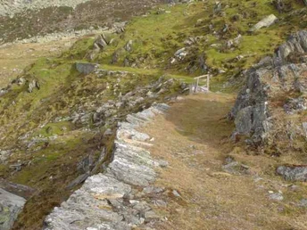
From Göschenen to the Häderlisbrücke in the Schöllenenschlucht, the route runs on the main road; there, you switch to the other side of the valley onto a narrow, quite steep path.
At Brüggwald, the main road is crossed, where the old mule track is an alternative to the main road. After the Devil's Bridge, you reach Andermatt and continue on the Oberalp pass road to Nätschen. From there, you ride on a natural road to Gütsch and further up to Stöckli.
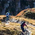
The descent through Riental is very difficult and should only be attempted in dry conditions. It starts at the highest 180-degree curve below Stöckli; the entrance to the path is on the right when viewed from above near the military cable car. On the way down to Göschenen, over 1300 meters of altitude must be overcome. In the lowest part, you often have to push the bike - due to scree, high steps, or yawning abyss.
Good to know
Pavements
Best to visit
Directions
Tour information
Loop Road
Nature Highlight
Stop at an Inn
Equipment
- Clothing appropriate to the weather
Directions & Parking facilities
Göschenen is directly connected to the A2 motorway and is therefore very easily accessible.
There are many parking options at the station in Göschenen and also in the village near Coop. Alternatively, you can also park in Andermatt and take the train to Göschenen.
Göschenen is very well connected by train from Ticino as well as Andermatt and generally from Central Switzerland. The timetable is as follows: SBB Timetable
Additional information
- The operating times of the Gütsch-Express gondola are as follows: Andermatt+Sedrun+Disentis
- If you have any further questions, please feel free to contact: Holiday Region Andermatt, +41 41 888 71 00, [email protected]
Author
Andermatt-Urserntal Tourismus GmbH
Organization
Région de vacances Andermatt
Author´s Tip / Recommendation of the author
- Detour to Lutersee
Safety guidelines
- The descent through Riental is very difficult and should only be attempted in dry conditions.
Nearby


