Hike to Schilteli


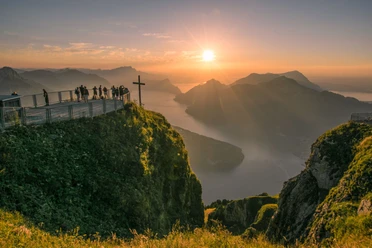
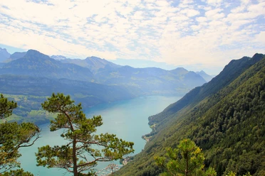
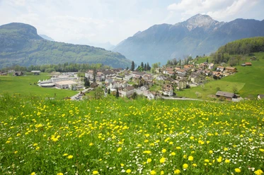
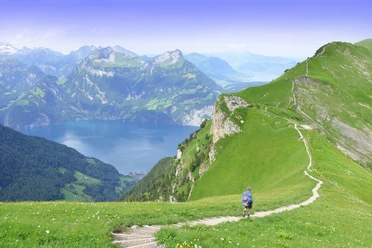
The hike to Alp Schilteli starts at the tourism square in the village center of Morschach. A small part of the route runs along the "Weg der Schweiz" and then turns east towards Degenbalm. Uphill and through the forest, you reach the Hetzig farmstead. From this platform, you can easily overlook the entire village of Morschach. The path then follows the natural road through a forest to the Alp Schilteli junction. The mountain path to the destination leads you through shady forest and along the Lauitobel. In the upper part of the trail, comfortable wooden steps have been built, and on the valley side, for safety reasons, a sturdy fence is everywhere. At Alp Schilteli, a magnificent panorama opens up. From the Schwyz basin to the Uri Alps, everything lies before you, you can even spot Seelisberg with the small lake. The return leads downwards on the natural road through the Schilteli forest. Those who remain quiet may have the chance to spot some wildlife here. To avoid returning on the same path to Morschach, leave the road towards the west and hike over the Schilti farmstead, practically towards Lake Lucerne. When you reach the road, take the path towards Morschach. You will then be back on the "Weg der Schweiz" which leads to the village. Near the destination, you will also pass idyllic farmsteads and two chapels inviting you to a little peace.
- 3:00 h
- 7.06 km
- 575 m
- 575 m
- 643 m
- 1,122 m
- 479 m
- Start: Morschach
- Destination: Morschach
Good to know
Pavements
Best to visit
Directions
Morschach - Degenbalm - Hetzig - Schilteli - Hinter Schilteli - Morschach
Tour information
Loop Road
Stop at an Inn
Equipment
Good hiking shoes with a good tread or trekking shoes.
Directions & Parking facilities
Coming from Basel-Lucerne:
Drive from Lucerne onto the A14 towards Zug. After 20 km, you reach the Rütihof motorway junction. There you take the A4 motorway towards Schwyz. At Brunnen, the motorway ends in a dual carriageway. Stay on this route towards Gotthard / Morschach. After the 1.1 km long Mosi tunnel, after 500 m turn left off the road towards Morschach.
Coming from Lake Constance and Rapperswil:
At Rapperswil, drive in the direction of Pfäffikon / Gotthard. At Pfäffikon, a short section on the A3 motorway leads towards Gotthard. Immediately take the first exit towards Gotthard / Schwyz again. The country road leads you over Rothenthurm and Sattel to Schwyz. At Schwyz, take the T8 bypass and then the A4 motorway towards Gotthard / Brunnen. At Brunnen, the motorway ends in a dual carriageway. Stay on this route towards Gotthard / Morschach. After the 1.1 km long Mosi tunnel, after 500 m turn left off the road towards Morschach.
Coming from Gotthard-Altdorf:
At Flüelen, take the bypass (tunnel) towards Schwyz. 500 m before Brunnen, turn right towards Morschach.
There are enough parking spaces available in the village.
Morschach is located on a sunny plateau above Lake Lucerne. The village can be reached by public transport from Brunnen with line 504 operated by Auto AG Schwyz.
Additional information
Author
Stoos-Muotatal Tourismus GmbH / Schwyzer Wanderwege
Organization
Stoos-Muotatal Tourismus
Map

Nearby

Download GPX file