Hochstollen circular route, Melchsee-Frutt


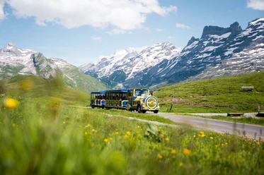
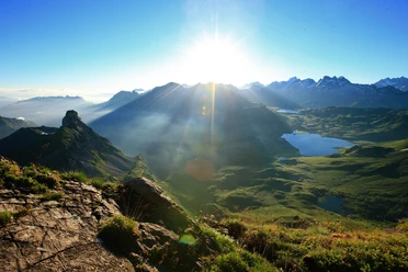
This panoramic hike is worth every drop of sweat. The start is at the old mountain station at Melchsee-Frutt. You walk along the Melchsee to the Balmeregg valley station. From here, it goes steeply uphill to the Balmeregghorn. From the bench, you enjoy a wonderful view of the Bernese Alps and the Titlis. With some luck, you may spot marmots, chamois, or ibex on the leisurely hiking trail via Planplatte to Hääggen. Then it goes uphill again via Hohsträss to the Wit-Ris notch and then further along the steep mountain hiking trail to the Hochstollen. A breathtaking panoramic view rewards the climb every time. After a picnic break, you tackle the steep descent via Abgschütz to the Blausee and back to the Frutt village.
- 6:30 h
- 18.38 km
- 1,000 m
- 1,000 m
- 1,893 m
- 2,481 m
- 588 m
- Start: Melchsee-Frutt, old mountain station
- Destination: Melchsee-Frutt, old mountain station
Waypoints

Good to know
Pavements
Best to visit
Directions
Melchsee-Frutt – Balmeregghorn – Planplatten – Hääggen – Hochstollen – Abgschütz – Melchsee-Frutt
Tour information
Loop Road
Nature Highlight
Stop at an Inn
Summit
Directions & Parking facilities
Paid parking available in Sarnen.
Additional information
For tourist information: Nidwalden Tourism
Author
Nidwalden Tourismus
Organization
Nidwalden Tourismus
Author´s Tip / Recommendation of the author
Safety guidelines
The Hochstollen circular route offers a unique mountain experience with good fitness and mountain suitability. The mountain paths are in good condition. Some sections are very steep.
Map

Nearby
Download GPX file