Höch Gumme round route


The aerial cable car takes about five minutes to ascend the 800 meters in altitude from Lungern to Turren. For those who are not afraid of heights, there is an incredible view of Lungern and Lake Lungern even during the cable car ride.
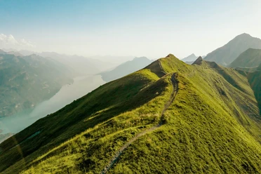
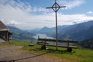
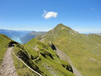
The route starts first on the asphalt road up to Dundelegg. From here, the path leads steeply uphill to Mändli, where a short stop is worthwhile. The special Mändlikreuz with the Sarneraatal in the background is a great photo subject. The path continues along the ridge, past Arnifirst to the summit. From Höch Gumme, the view of Lake Brienz and the Wetterhorn group is unique. Eiger, Mönch, and Jungfrau are also clearly visible.
After a short descent, the Berghaus Schönbüel offers a long and well-deserved break. Afterwards, the path continues downhill to Alp Breitenfeld. In summer, regular church services still take place in the alpine chapel. Finally, the descent back to Turren follows.
- 4:05 h
- 11.00 km
- 814 m
- 814 m
- 1,452 m
- 2,202 m
- 750 m
- Start: Turren, mountain station Lungern-Turren-Bahn
- Destination: Turren, mountain station Lungern-Turren-Bahn
Waypoints
Good to know
Best to visit
Tour information
Loop Road
Stop at an Inn
Summit
Directions & Parking facilities
Additional information
Author
Obwalden Tourismus
Organization
Obwalden Tourismus
Author´s Tip / Recommendation of the author
Those who are not yet satisfied with the view after the hike can enjoy a drink with cake on the sun terrace of the Restaurant Turren.

Nearby
Download GPX file