Karstspur Silberen


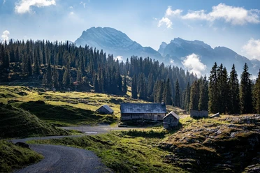
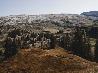
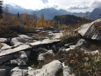
The ascent takes you steadily away from grazed alpine pastures to the inhospitable, bizarre karst region of the Silberen. The whistle of marmots shows that you have long been discovered. Chamois also understand the signal and flee. Hardly imaginable that 10,000 years ago prehistoric hunters definitively hunted red deer and ibex here. Near the summit cross you will find traces of a long-gone settlement. The breathtaking panoramic view and solitude invite you to linger. From here the widely visible marked trail leads across the high plateau towards the east and finds its way through a water-shaped, legendary karst landscape. With some luck, ptarmigans appear here. Unexpectedly quickly you find yourself in the extensive sheep pastures of the Silberenalp. Countless small water puddles reflect the sunlight. The return path to Pragel is characterized by the view into the Klöntal with its deep blue mountain lake.
- 5:45 h
- 13.92 km
- 864 m
- 864 m
- 1,542 m
- 2,315 m
- 773 m
- Start: Pragelpass
- Destination: Pragelpass
Good to know
Pavements
Best to visit
Directions
Pragelpass - Butzen - Silberen - Alpeli - Pragelpass
Tour information
Loop Road
Stop at an Inn
Directions & Parking facilities
Additional information
SchweizMobil: Karstspur Silberen
Literature
Author
Stoos-Muotatal Tourismus GmbH
Organization
Schwyzer Wanderwege
Safety guidelines
Season:
Attention: The area is rainy and can have snowfields into spring.
Surface/Ground:
Attention: Karst is heavily fissured and requires sure footing.
Signposting:
Attention: As landscape orientation points are missing on the high plateau, more markings than usual are installed.

Nearby
Download GPX file