Lauerz - Husmatt - Lauerz
Lauerz, the jewel in the sunny heart of Switzerland, lies on the idyllic Lake Lauerz and at the foot of the Rigi and invites you to enjoy good food, hiking, cycling, and relaxing.
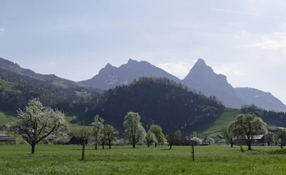
On this short hike at the edge of the village of Lauerz you will experience nature near Lake Lauerz with constant views of the Rigi and the Rossberg, featuring the gigantic collapse of the Goldau rockslide in 1806.
Notes
So that future generations can also enjoy nature, we ask you to take your rubbish home with you. Thank you.
- 1:30 h
- 2.96 km
- 144 m
- 144 m
- 448 m
- 591 m
- 143 m
- Start: Lauerz
- Destination: Lauerz
Good to know
Pavements
- Street (57%)Trail (43%)
Best to visit
- suitableDepends on weather
Directions
- Lauerz (450 m) - Schlüchtli (606 m) - Ottental (499 m) - Husmatt - Seematt - Lauerz (450 m)
Tour information
Circular trail
Equipment
- Hiking boots with good grip or trekking shoes, rain jacket, drink, food, possibly sticks.
Directions & Parking facilities
- Getting there
Drive from the Goldau motorway exit towards Lauerz.
However, we recommend public transport instead of driving: sit back, enjoy, and do something good for the environment at the same time.
ParkingIn the village of Lauerz there are paid parking spaces available.Public transportationLauerz is accessible by public transport. More information can be found here: SBB Timetable AAGS Timetable
Author
Gäste-Service Rigi
Organization
Schwyzer Wanderwege
Author´s Tip / Recommendation of the author
I recommend tackling the short ascent to Weidstein and enjoying the wonderful view of Lake Lauerz.
Nearby



Download GPX file