Mäderenweg


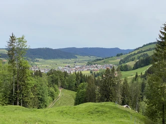
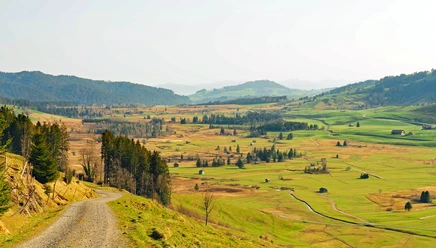
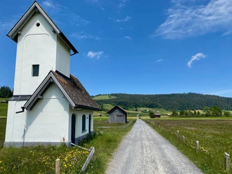
Start in the center of Rothenthurm at the St. Antonius Parish Church Rothenthurm and follow the signposted route of SchweizMobil number 836. After Biberegg, cross the Steiner Aa. From there, the ascent begins over meadows and through the forest. Along the route, you repeatedly enjoy a great panorama. You look at the village of Rothenthurm and the Ägerital. But also the surrounding peaks like the Rigi massif as well as the Schwyz, Uri, and Bernese Alps can be seen. Then you enter the Mäderen forest. Upon reaching the small stream, the highest point of the route is reached and then you go down again. The destination is Mostelberg. There you can relax comfortably at the Mostelberg mountain inn and then take the revolving gondola lift Sattel-Hochstuckli down to the village of Sattel.
- 2:00 h
- 6.23 km
- 354 m
- 107 m
- 927 m
- 1,250 m
- 323 m
- Start: St. Antonius Parish Church Rothenthurm
- Destination: Mostelberg
Good to know
Pavements
Best to visit
Directions
Rothenthurm 920 m.a.s.l - Obermüsli 958 m.a.s.l - Mäderen 1153 m.a.s.l - Mostelberg 1174 m.a.s.l
Equipment
Good footwear, hiking backpack, hiking poles.
Directions & Parking facilities
Rotenthurm is located on the H8 between Pfäffikon and Schwyz.
Parking is available at the station or at the Rotenthurm school.
By train or bus from Schwyz to Rotenthurm station. Timetable information can be found here: www.sbb.ch
Author
Natalie Buck
Organization
Schwyzer Wanderwege
Author´s Tip / Recommendation of the author
To shorten the ending, you can cross the 374-meter-long "Skywalk" suspension bridge.

Nearby