Meiggelenstock


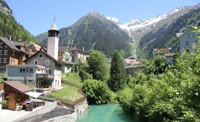
The hike starts in Wattingen near Wassen. Through dense and shady forest with clearings full of raspberries, Rüti is reached. After the forest border, the route leads over Farneren to Rorgrund. The valley widens and the steep ascent takes hikers to the path coming from Bandlückli and Salbithütte SAC. The last meters to the summit are steep, but the view is overwhelming. From Gemsstock over Bristenstock, the view wanders to Kleine Windgälle in the northwest and Höreli in the north. After a short descent to the Rorplatten, the hiking trail passes over glacier-polished granite rocks at about 2200 m above sea level to the northern side of the bowl. Over a short steep section, Langsee is reached and even higher the Gross See. Together with the Chli See, these lakes form a mystical landscape in a barren and rocky area. From Gross See, hikers can descend to Rorgrund and directly down the left side of the valley to Wassen. The path is steep but quite walkable.
- 7:50 h
- 15.24 km
- 1,663 m
- 1,663 m
- 908 m
- 2,414 m
- 1,506 m
- Start: Bus stop Wassen Post
- Destination: Bus stop Wassen Post
Good to know
Pavements
Best to visit
Directions
Bus stop Wattingen behind Wassen - Farneren - Rorgrund - Bandlückli - Salbithütte SAC - Meiggelenstock - Rorplatten - Langsee - Gross See/Chli See - Rorgrund - Wassen
Tour information
Loop Road
Nature Highlight
Stop at an Inn
Summit
Tour with Dog
Equipment
- Clothing appropriate for the weather
- Good footwear
- Hiking poles are recommended
- Binoculars
- Camera
- Day backpack
Directions & Parking facilities
Wassen is directly connected to motorway A2 via a motorway exit. The Gotthard motorway is the connecting road between Ticino and Central Switzerland.
In Wassen there are some parking spaces directly next to the old train station. In addition, there are also some parking options in the village.
Wassen is very well accessible by public transport. Take the train to Göschenen or Erstfeld, then take the bus to Wassen. The timetables are as follows: Auto AG Uri timetable and SBB timetable
Additional information
- Further information on Salbithütte can be found at: Salbithütte
- For further questions, please contact: Andermatt holiday region, +41 41 888 71 00, [email protected]
Author
Andermatt-Urserntal Tourismus GmbH
Organization
Région de vacances Andermatt
Author´s Tip / Recommendation of the author
- "Chileli" from Wassen (famous church)
- Swimming in the lakes
Safety guidelines
Hikers should keep an eye on the weather forecast in advance, as parts of the hike are above 2000 m above sea level and, in extreme cases, light snowfall can occur.
Nearby

Download GPX file