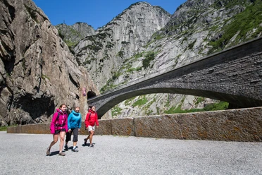
Regliberg Circular Hike


The circular hike has a lot to offer. It starts in the small idyllic village of 300 inhabitants. Then it goes up with a view over the Göschenertal and the village of Göschenen to Regliberg. With a fantastic view, a picnic break is worth it before starting the descent. From Regliberg, it goes down into the Göschenertal valley. From there it continues back to Göschenen passing various barbecue spots, meadows, forests, and along a river.
- 3:00 h
- 7.50 km
- 597 m
- 597 m
- 1,084 m
- 1,681 m
- 597 m
- Start: Göschenen Train Station
- Destination: Göschenen Train Station
Good to know
Pavements
Best to visit
Directions
Tour information
Loop Road
Equipment
- Clothing appropriate for the weather
- Good footwear
- Hiking poles are recommended
- Binoculars
- Camera
- Daypack
Directions & Parking facilities
Göschenen is directly connected to the A2 motorway and therefore very easily accessible.
There are many parking options at the train station in Göschenen as well as in the village near Coop.
Göschenen is very well connected by train from Ticino as well as Andermatt and generally Central Switzerland. The timetable is as follows: SBB Timetable
Additional information
If you have further questions, feel free to contact: Andermatt Holiday Region, +41 41 888 71 00, [email protected]
Author
Andermatt-Urserntal Tourismus GmbH
Organization
Région de vacances Andermatt
Author´s Tip / Recommendation of the author
- For those interested, a visit to the Gotthard Tunnel Info Center is worthwhile before or after the hike: Gotthard Tunnel Info Center
Safety guidelines
In the Alps, the weather can change quickly, so it is advisable to carry weatherproof clothing in your backpack.
Nearby


Download GPX file