Merger Route Triengen


A DISCOVERY JOURNEY WITH DIVERSE EXPERIENCES
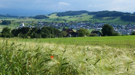
The merger route is continuously signposted and can be easily completed in stages. Regional bus services connect various points along the route with the nearest train stations in Sursee and Schöftland. Along the way, there are also benches for resting, farm shops that would be happy to receive visitors, or opportunities to stop for a break. Attractions not directly on the route are signposted and indicated. The merger route is lined with panorama boards as well as several time travel boards. They offer exciting insights into local and landscape historical contexts with text, image, and sound – a journey into the past of Triengen and the Surental. Enjoy your journey on the merger route.
- 7:45 h
- 29.12 km
- 679 m
- 690 m
- 475 m
- 837 m
- 362 m
- Start: Moosgassstrasse (underpass), Triengen LU
Good to know
Best to visit
Tour information
Loop Road
Directions & Parking facilities
Arrival:
- PostBus from Sursee (PostBus 85)
- PostBus from Schöftland (PostBus 85)
Additional information
Author
Peter Regli
Organization
Sempachersee Tourismus

Nearby
Download GPX file