Natural History High Path Isenthal Route 3


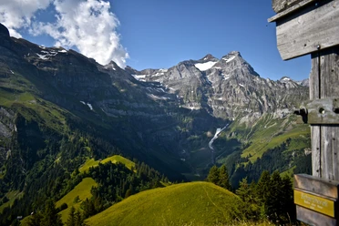
For centuries, Isenthal was hidden for a large part of the population of Uri. The municipality of Isenthal, today's hiking area, was only accessible on foot from the communities of Bauen/Seedorf by the old country road. Hikes in the small and large valley and the crossings to the neighboring cantons were considered inconvenient and time-consuming. Today the village of Isenthal is well connected as a starting point for numerous rewarding hikes using public transport. The "Natural History High Path Isenthal" over Sassigrat lies in the federal protected hunting area. It shows an extremely rich biodiversity.
- 4:00 h
- 8.65 km
- 1,287 m
- 52 m
- 1,691 m
- 2,926 m
- 1,235 m
- Start: Biwaldalp
- Destination: Uri Rotstock
Good to know
Pavements
Best to visit
Directions
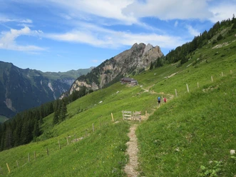
Route 3 branches off as a mountain path near the Biwaldalp mountain guesthouse towards Uri Rotstock. The path leads through alpine meadows to Hoch Egg and over Breit-Planggen to the signpost on the hill "Im Lauberz". Here, the mountain path marked white-red-white points to the nearby Gitschenhörelhütte (private hut). Keys available at the Biwaldalp mountain guesthouse: phone 041 878 11 62. Private 041 878 14 30. There is an emergency call station of Rega at the Gitschenhörelihütte. However, operation is not always guaranteed!
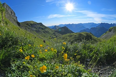
The blue signpost and the white-blue-white markings indicate the "Alpine Path". It leads over the lateral moraine of the Blümlisalp peak towards viewpoint 2753 and over point 2740 west of point 2826 to saddle 2798. Via the southwest flank, one reaches the rewarding summit destination Uri Rotstock at 2928m.
Tour information
Cultural Interesting
Nature Highlight
Stop at an Inn
Summit
Equipment
Directions & Parking facilities
Additional information
Literature
Author
Priska Herger
Organization
Verein Urner Wanderwege
Author´s Tip / Recommendation of the author
Buy the booklet «Natural History High Path Isenthal» at the village shop or Hotel Urirotstock. It contains numerous information.
Safety guidelines
Map
Urner hiking and biking map, sheet Urnersee 1:25,000
Orderable at:

Nearby