Naturkundlicher Höhenweg Isenthal Route 1


For centuries, Isenthal was hidden to a large part of the Uri population. The municipality of Isenthal, the current hiking area, was only accessible on foot from the municipalities of Bauen/Seedorf via the old country road. Hikes in the Chli- and Grosstal and crossings into neighboring cantons were considered cumbersome and time-consuming. Today, the village of Isenthal is well connected as a starting point for numerous rewarding hikes via public transport. The "Naturkundlicher Höhenweg Isenthal" over Sassigrat lies within a federal hunting reserve. It features an extremely rich biodiversity.
- 6:50 h
- 18.75 km
- 1,199 m
- 1,199 m
- 768 m
- 1,869 m
- 1,101 m
- Start: Isenthal Post
- Destination: Isenthal Post
Good to know
Pavements
Best to visit
Directions
Route 1 begins at the Post Isenthal. It passes by charming houses heading down the valley, always along the Isitaler Bach, until reaching St. Jakob (post bus stop). The natural road starting after 300 m branches off at the next signpost into the Rüti and Gross Forest. Our path, however, leads over the Alps Chimiboden, Steinhüttli, Wilderbutzenstafel to Biwaldalp. The mountain inn Biwaldalp, which is managed from early June to mid-October and offers rooms and a dormitory for 60 people, is considered a refreshing rest spot and invites you to linger.
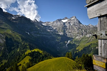
The signpost between the house and the stable directs us over the alpine meadows northward to the lowest point of the Sassigrat. From the ridge, we enjoy the view down into the two valleys and the surrounding mountains. The descent over the steep grassy slope is clearly visible.
The mountain inn Musenalp, open from mid-May to mid-October, offers accommodation for 70 people. The rocks of the Uri Rotstock massif are threateningly close. At Musenalp, a blue signpost indicates the "Alpine Path" in the direction of Uri Rotstock, caution is advised.
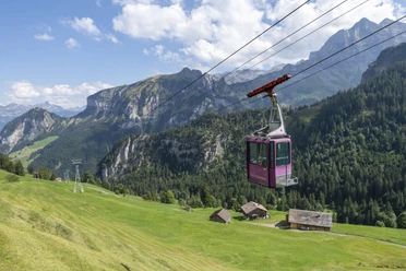
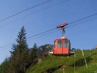
For the descent into Chlital, the cable car can be used during the alpine season. The paved service road leads down the valley to the village of Isenthal.
Tour information
Cultural Interesting
Loop Road
Mountain Railway Tour
Nature Highlight
Stop at an Inn
Equipment
Directions & Parking facilities
Additional information
Literature
Naturkundlicher Höheweg Isental
https://www.worldcat.org/title/naturkundlicher-hohenweg-isenthal-isenthal-grosstal-st-jakob-steinhuttli-biwaldalp-sassigrat-musenalp-chlital-gitschenhorelihutte-uri-rotstock/oclc/62571185
Author
Priska Herger
Organization
Verein Urner Wanderwege
Author´s Tip / Recommendation of the author
Safety guidelines
Map
Uri hiking and bike map, sheet Urnersee 1:25,000
Orderable at:
https://www.urnerwanderwege.ch/de/shop

Nearby
Download GPX file