On the trail of the Gieslibach


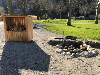
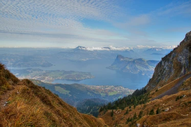
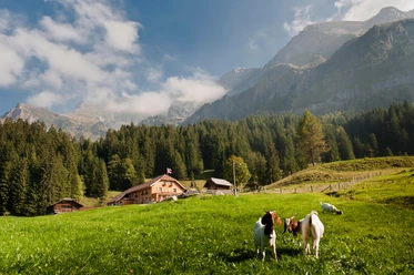
From the boat landing, the path gently follows the lake to the multipurpose facility. A steep climb leads up to Fürigen in the shade of the forest. Suddenly, in the forest, the Balmchäppili and the „Swiss Family“ campfire „Unter Stegmatt“ with seating for around 25 people appear. While the grilled food roasts on the embers, badminton can be played on the leveled roof of the water reservoir. The path continues a little above the Gieslibach towards Obbürgen. The surroundings change - it becomes somewhat more open and one walks past farms and meadows. In the middle of the meadow on the commons, it can be guessed where the spring source of the Gieslibach is. After the gentle ascent to the Bergkäse dairy Boden, it continues steeply upwards over the meadow to the Bürgenstock Resort. The reward for this is the magnificent view of Lake Lucerne and the mountain world.
- 3:10 h
- 7.55 km
- 479 m
- 48 m
- 433 m
- 869 m
- 436 m
- Start: Stansstad, boat landing
- Destination: Bürgenstock Resort, Obbürgen
Waypoints
Good to know
Best to visit
Directions
Stansstad - Obbürgen - Bürgenstock
Directions & Parking facilities
Outbound journey:
Stansstad, train station: SBB Timetable
Stansstad, boat landing: SGV Timetable
Return journey:
Bürgenstock, center: PostAuto Timetable
Bürgenstock railway and boat: Timetable
Additional information
For tourist information: Nidwalden Tourism
Author
Nidwalden Tourismus
Organization
Nidwalden Tourismus
Author´s Tip / Recommendation of the author
Take a coffee break in the cozy garden of the Kilchbüel Farm, Obbürgen, and enjoy homemade ice cream.

Nearby


