Riedmattstöckli


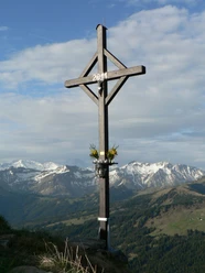
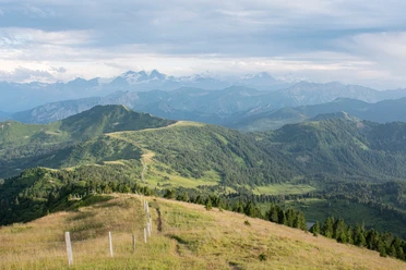
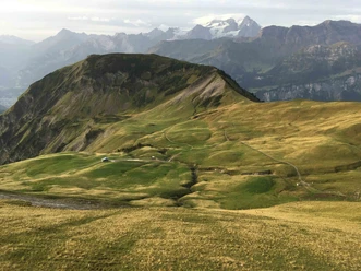
The hike begins in Zwirchi, at 1400 m, first over alpine meadows, then through a beautiful fir forest, slightly uphill to Riedmattschwand. We then gradually reach the Guberegg via the alpine meadows of Riedmatt. Another short climb to the Riedmattstöckli, where there is a magnificent view. Here you can see the surrounding mountains from a less familiar perspective. Then it's downhill again to Guberegg, at the same altitude to Miesenalp and then over to the Sattelpass. Hungry or thirsty? Here you will be served delicious cheese slices and good coffee.
The Sattelpass trail is an old historical crossing from Giswil to Entlebuch. In the past, many goods were transported over this pass by horse and sleigh.
Continue on, not down the asphalt road, but along the hiking trail towards Loo and after approx. 500 m. turn left down the Herrenwegli. At the bottom you will see the Chlus plant at Dörsmatt, after which a dirt road leads you back to the starting point at Zwirchi.
- 3:11 h
- 9.59 km
- 428 m
- 427 m
- 1,402 m
- 1,752 m
- 350 m
- Start: Zwirchi, Giswil
- Destination: Zwirchi, Giswil
Good to know
Best to visit
Directions
Tour information
Loop Road
Directions & Parking facilities
Author
Obwalden Tourismus
Organization
Obwalden Tourismus
Nearby
Download GPX file