Rotenflue - Furggelenstock circular hike


Already the gondola ride up to Rotenflue promises a breathtaking panorama. In the background, the Schwyz basin and Lake Uri stretch out, while in front the mighty Grosse Mythen welcomes the hikers. The Restaurant Gipfelstubli, directly at the mountain station of the Rotenfluebahn, offers the perfect place for a first "coffee stop" with its wonderful view.
From the mountain station of the Rotenfluebahn, the Schwyz high trail leads over lush alpine pastures, soft moor soil, and root-covered paths. The route goes via Müsli Egg, the Alpwirtschaft Zwäcken, and Halbegg up to Furggelenstock at 1656 meters above sea level. The last, somewhat steeper ascent is worth it, because at the top hikers are rewarded with a stunning 360-degree panorama over the Schwyz and Uri Alps.
Shortly after the summit, on the descent toward Bommersboden at the Furggelen junction, a short detour to the Alpwirtschaft Furggelen is worthwhile. The cozy sun terrace invites you to linger and offers a fantastic view of the impressive Mythen massif.
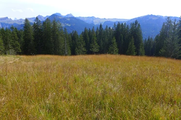
From Furggelen, the path leads through a varied landscape with moor areas, pastures, and forests – an area with damp soils that almost resembles Scandinavia. It is no wonder that the Swiss Landscape Foundation declared the moor forests of Ibergeregg the "Landscape of the Year 2019." These wetlands host a rich variety of species, including endangered animals such as the capercaillie and black grouse, the cuckoo, or the ring ouzel.
From Ibergeregg, the hike leads on well-developed paths – always accompanied by spectacular views of the Grosse Mythen, Lake Lucerne, Lake Lauerz, and the Schwyz pre-Alps – back to the Rotenfluebahn.
- 4:05 h
- 11.85 km
- 557 m
- 557 m
- 1,287 m
- 1,656 m
- 369 m
- Start: Rotenflue mountain station
- Destination: Rotenflue mountain station
Good to know
Pavements
Best to visit
Directions
Rotenflue - Müsli Egg - Zwäcken - Halbegg - Furggelenstock - Furggelen - Bommersboden - Hobacher - Ibergeregg - Zwäcken - Müsli Egg - Rotenflue
Tour information
Loop Road
Mountain Railway Tour
Nature Highlight
Stop at an Inn
Summit
Equipment
Hiking boots with good tread or trekking shoes, rain jacket, drink, food, possibly poles.
Directions & Parking facilities
By car
Drive on highway A4 to the Seewen/Schwyz exit. From there, proceed via Schwyz to Rickenbach to the valley station of the Rotenfluebahn.
Paid parking spaces directly at the valley station of the Rotenfluebahn.
Take the train to Schwyz. From there, take the bus of Auto AG Schwyz to Bus stop Rickenbach SZ, Rotenfluebahn
Additional information
Author
Erlebnisregion Mythen
Organization
Schwyzer Wanderwege
Author´s Tip / Recommendation of the author
Those who wish can shorten the hike by about 1 hour from Ibergeregg by taking the bus of Auto AG Schwyz.
Nearby


Download GPX file